Posts

two girls wearing sweaters with arms around shoulders stand on a cliff in Big Sur Willow Creek smiling

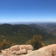
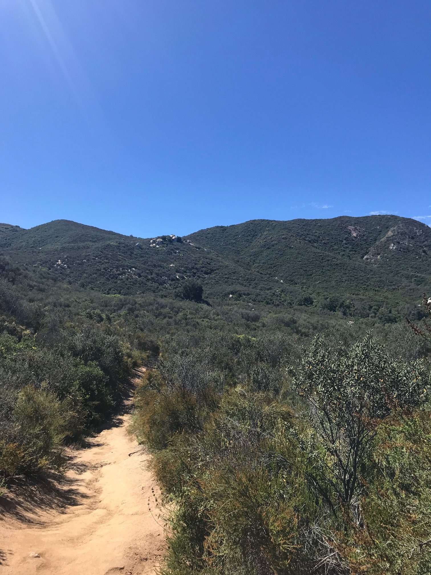
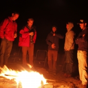
Disconnecting up North in Santa Cruz and Big Sur

two girls inside the car take a selfie in sunglasses during a road trip up the coast of California

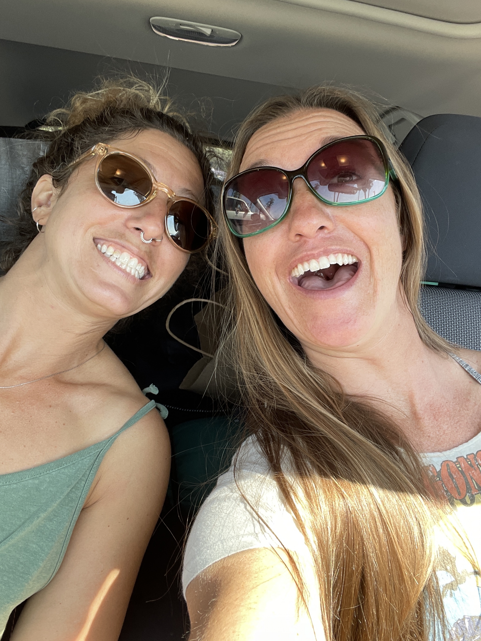
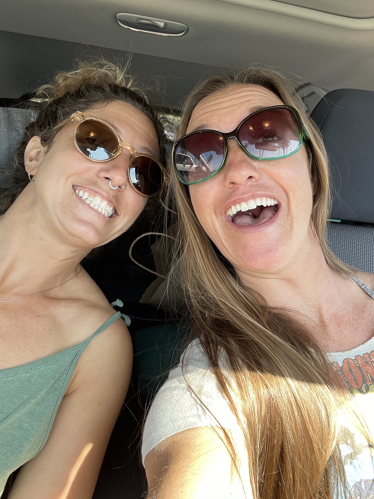
The first of many selfies.

About seven years ago this past April, I was surfing San Clemente State Park when I noticed this curly-haired chick wearing only a green Brazilian bikini paddling around in the lineup. The water had to be at least 60 degrees—nothing new for Southern California at this time of the year, but balmy by comparison from where she was from.

Curiosity got the better of me and we struct up a conversation being the only two women surfing at State Park that day. Lauren, being from New York, thought 60 degrees was warm water, thought all the guys on Tinder sucked, said we should go for the sets and paddled straight to the peak at pumping State Park—zero effs given.

Instant friendship.

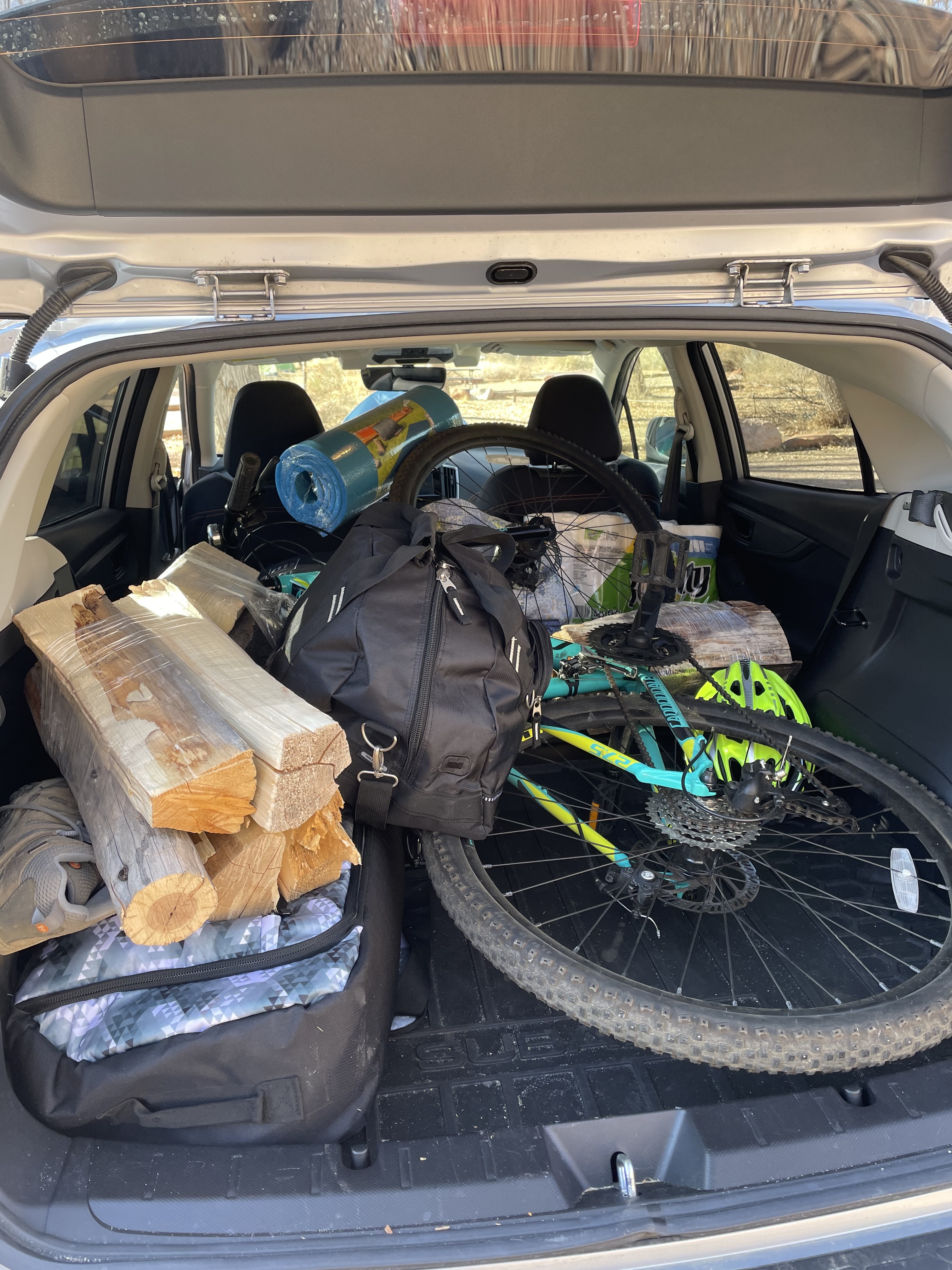
A few weeks ago, that same surfer girl and I decided to pack up my Subaru and drive up the coast to Santa Cruz and Big Sur to find some surf, eat A LOT of snackies, camp and just plain disconnect from this crazy world. In fact, she made me turn off work notifications and that was the BEST decision ever.

a bright pink champagne cake sprinkled with white powdered sugar at the Madonna Inn

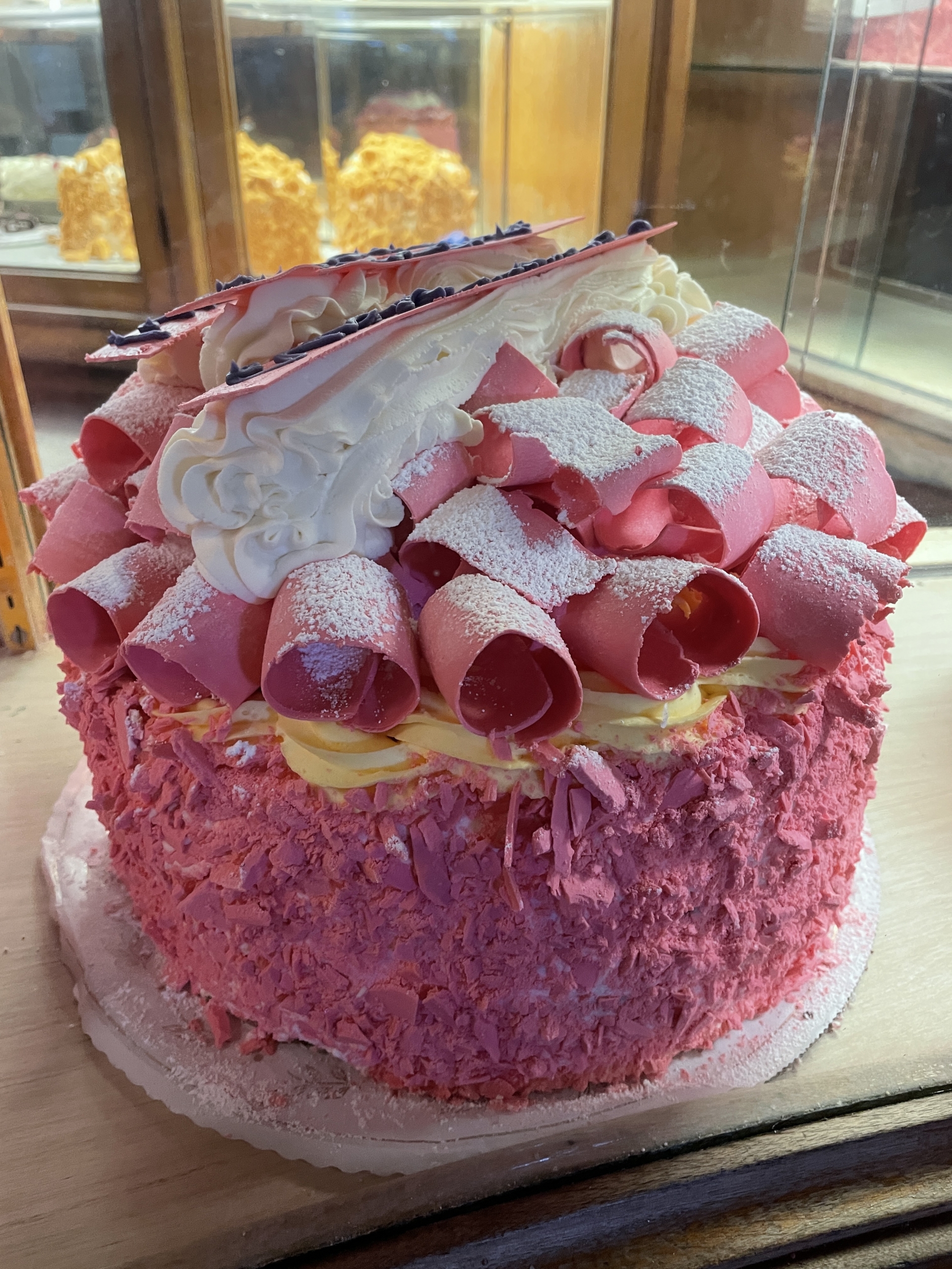
Marveling at the pink champagne cake at the Madonna Inn.

We had always talked about a trip together—I mean, why not?! She and I are typically on the same pages in life and (almost) the same speed in the surf. Although she has been known to tackle 15-foot peaks at Todos Santos, but that’s another story.

As with most surf road trips, we said ‘let’s leave at 6:00 a.m. and beat LA traffic!” My cat had other plans by keeping me up all night long and we also just plain lagged. But! Somehow traffic wasn’t that bad and we made it up to Ventura before 9:00 a.m. We stopped at my favorite little coffee shop, Sandbox Coffeehouse, to grab an awesome Chai latte and to (briefly) check C Street. Of course, it wasn’t working. To be continued…

a girl stands on a big rock by the ocean with her hand outstretched towards the ocean

Today, we have the small wave special served cold.

We burned past Santa Barbara and Carpinteria. We slipped past wine country and stopped at the Madonna Inn for a tasty, sweet treat. Deciding to take our time, we headed straight to Santa Cruz and would check Big Sur and Morro Bay on the way back. There was no swell in the forecast, so we weren’t in any rush.

After checking Moss Landing’s

a partly cloudy and windy beach scene with rough waves and yellow sand

Moss Landing, anyone want to surf?

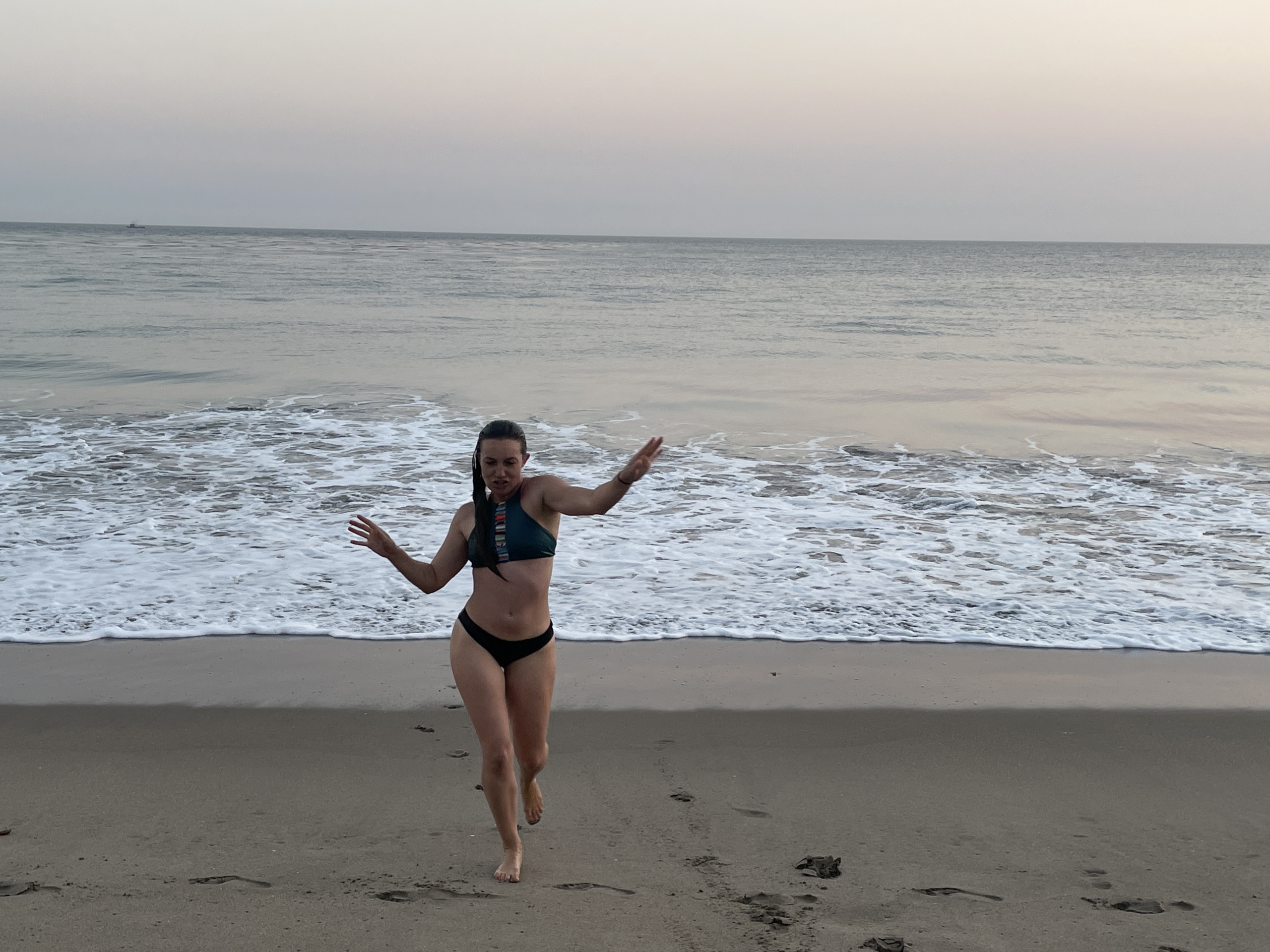
wind-blown beach breaks, we made our way into Santa Cruz, the hippie capital, and surfed Jack’s, close to Pleasure Point. Of course, the sun was setting and the water was, once again, a balmy 58-60 degrees. Lauren insisted we trunk it for our first sesh. Teeny tiny waves met our bikini-cladded bods as we skidded and surfed with longboards underfoot. I realize—I miss longboarding so much. The cold got the best of me first and I took the tiniest wave in. Lauren and I decided hot soup was the ticket for a post-surf dinner and we found calamari, a glass of wine and clam chowder at Water Street Grill most satisfying.

light streaming through the trees in the forest

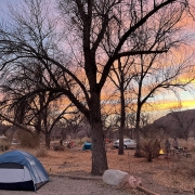
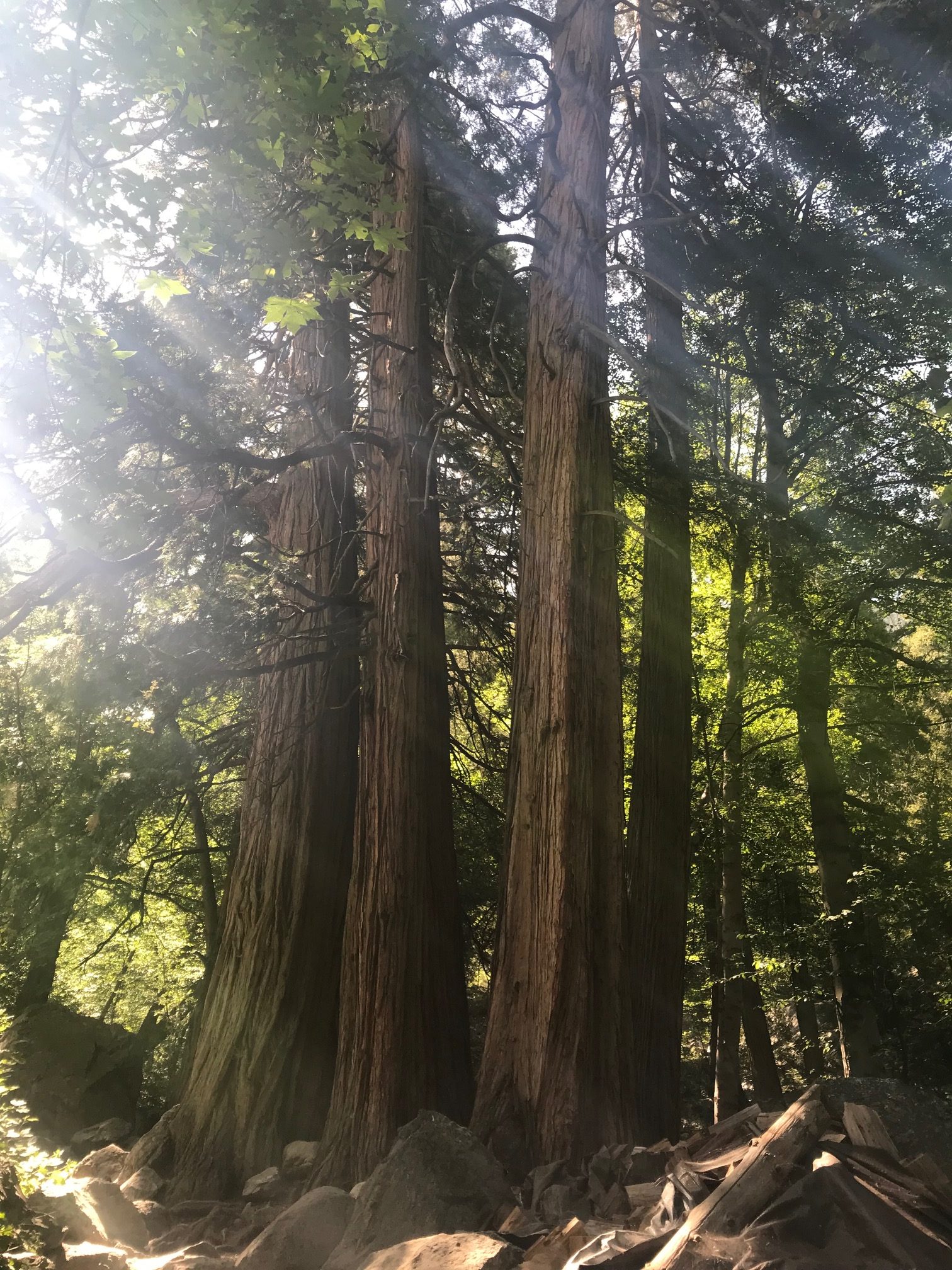
It is, indeed, a good morning, Henry Cowell campgrounds!

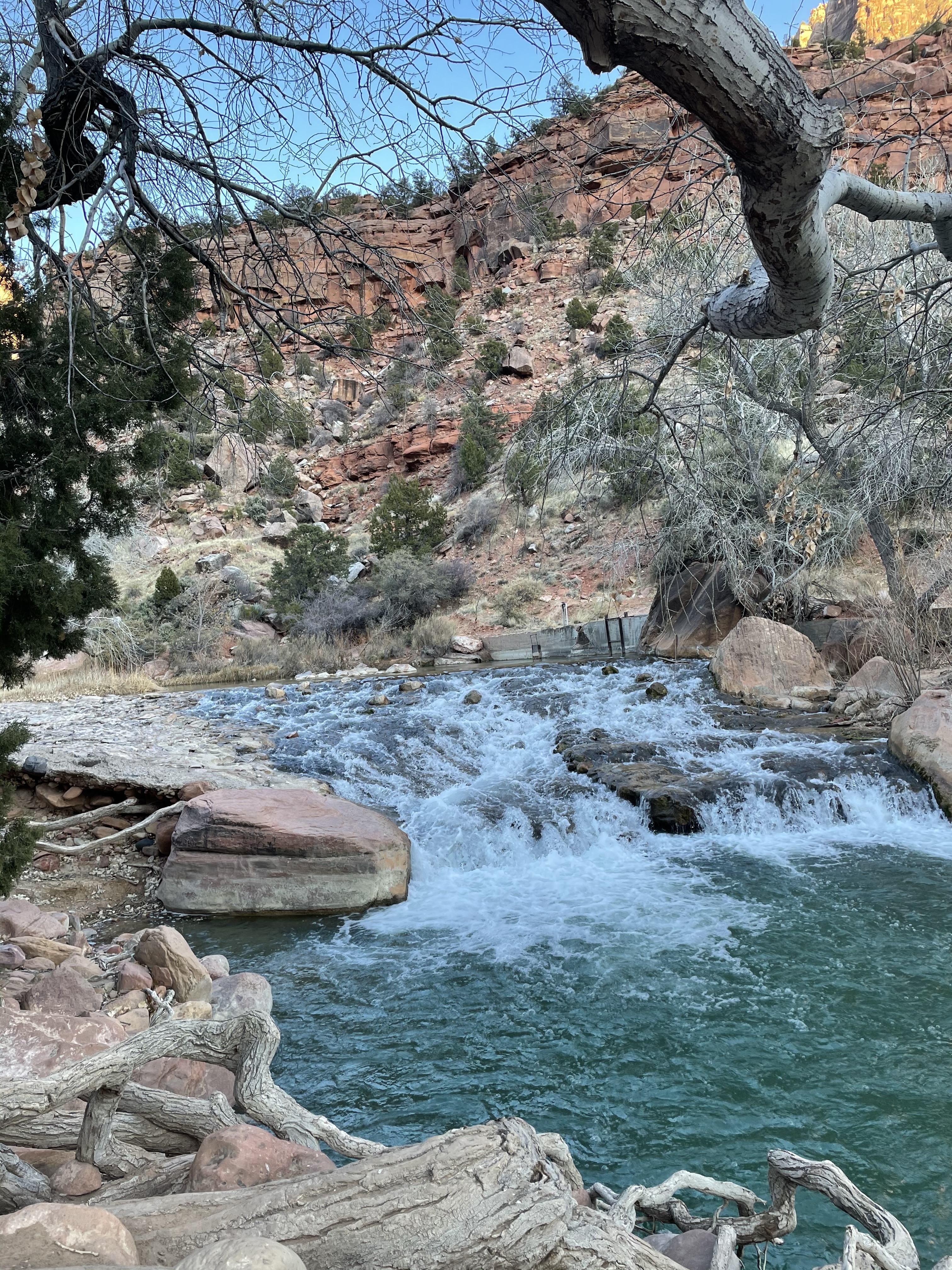
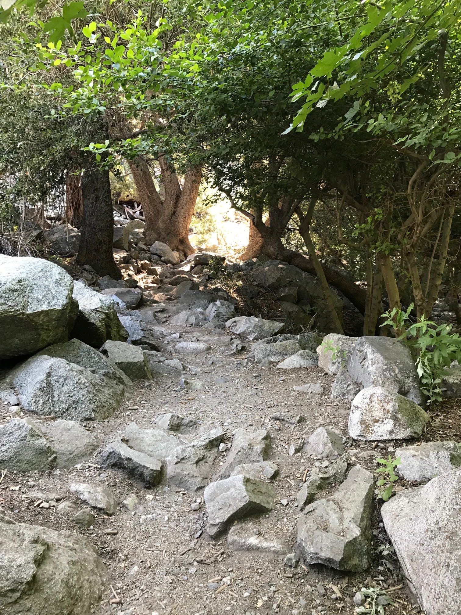
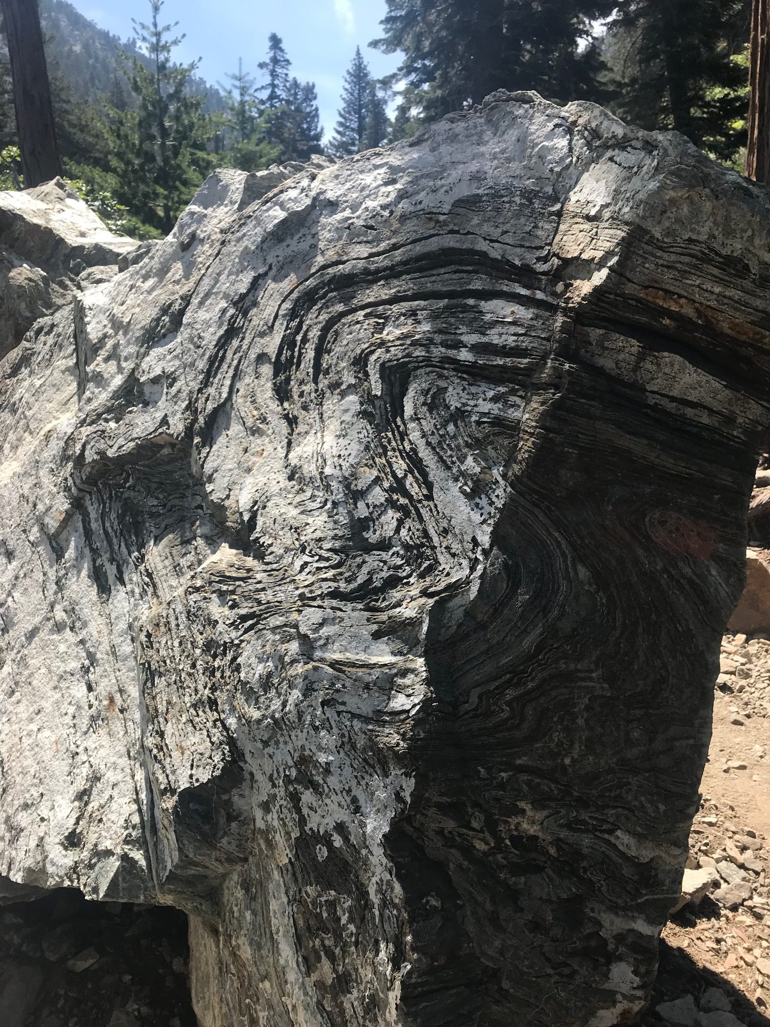
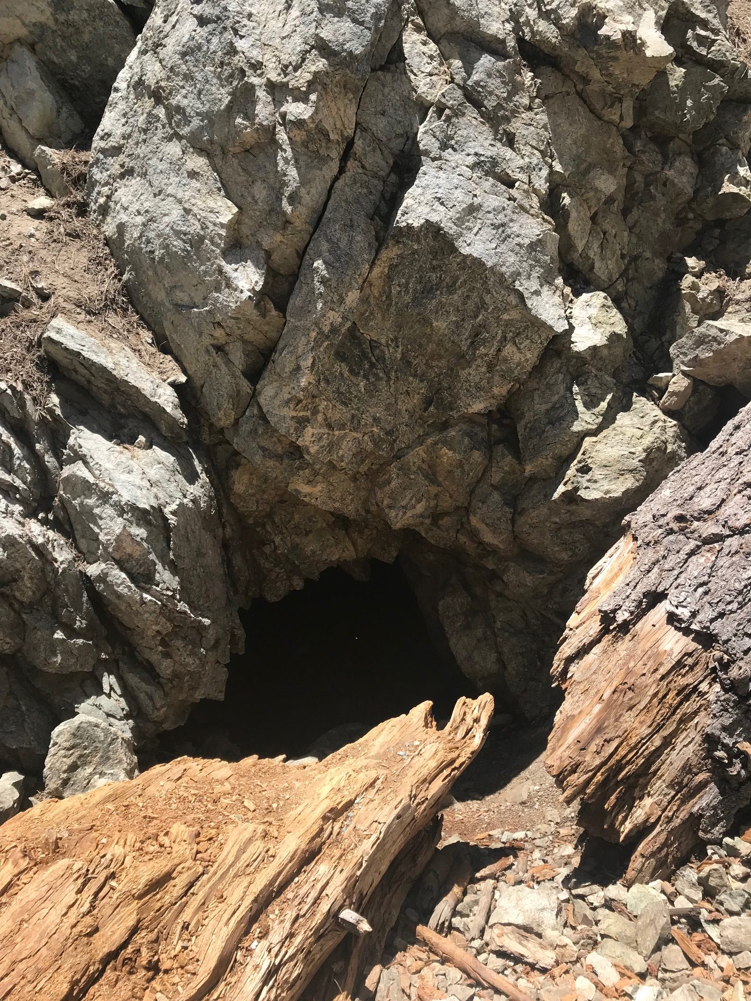
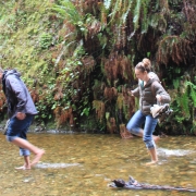
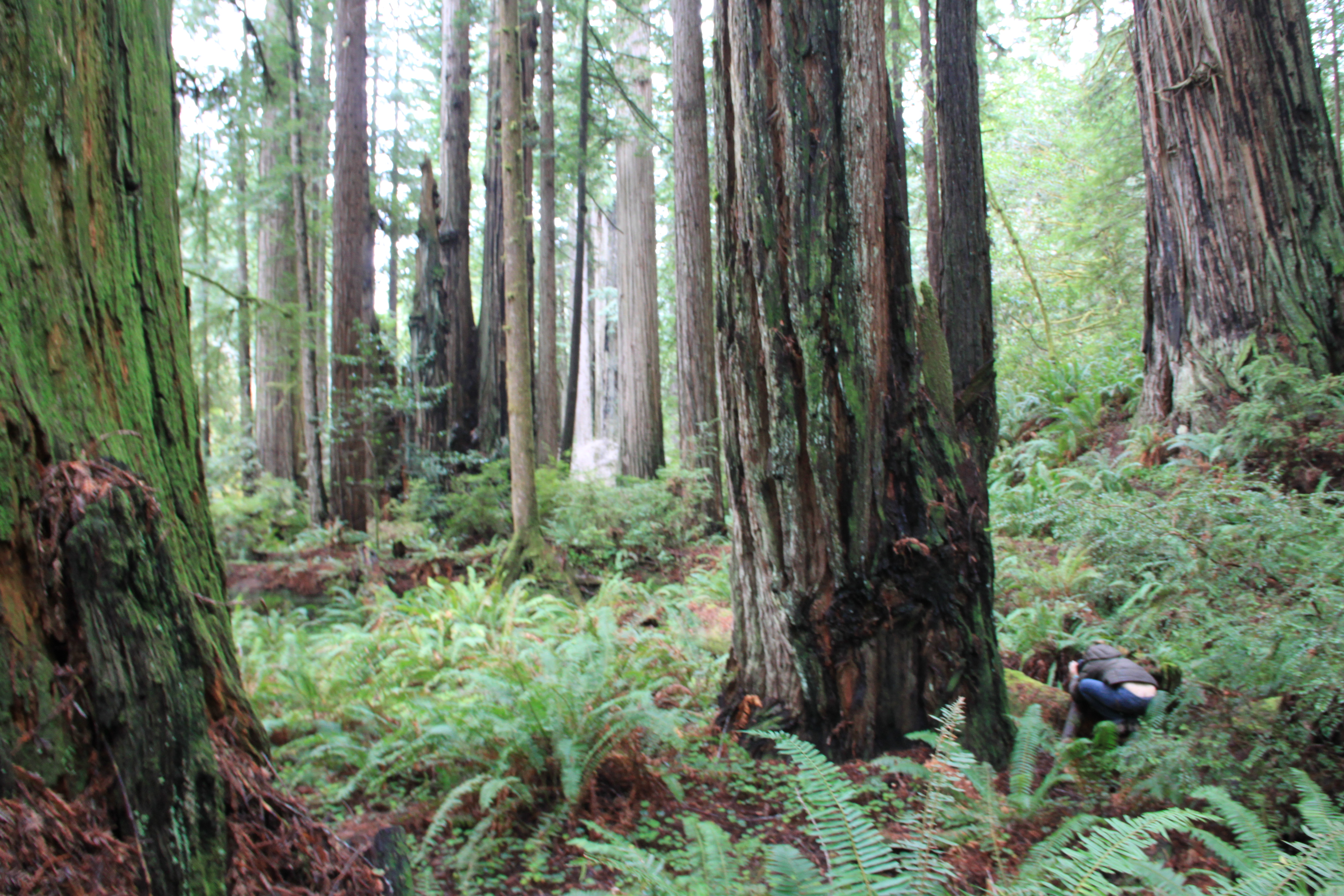
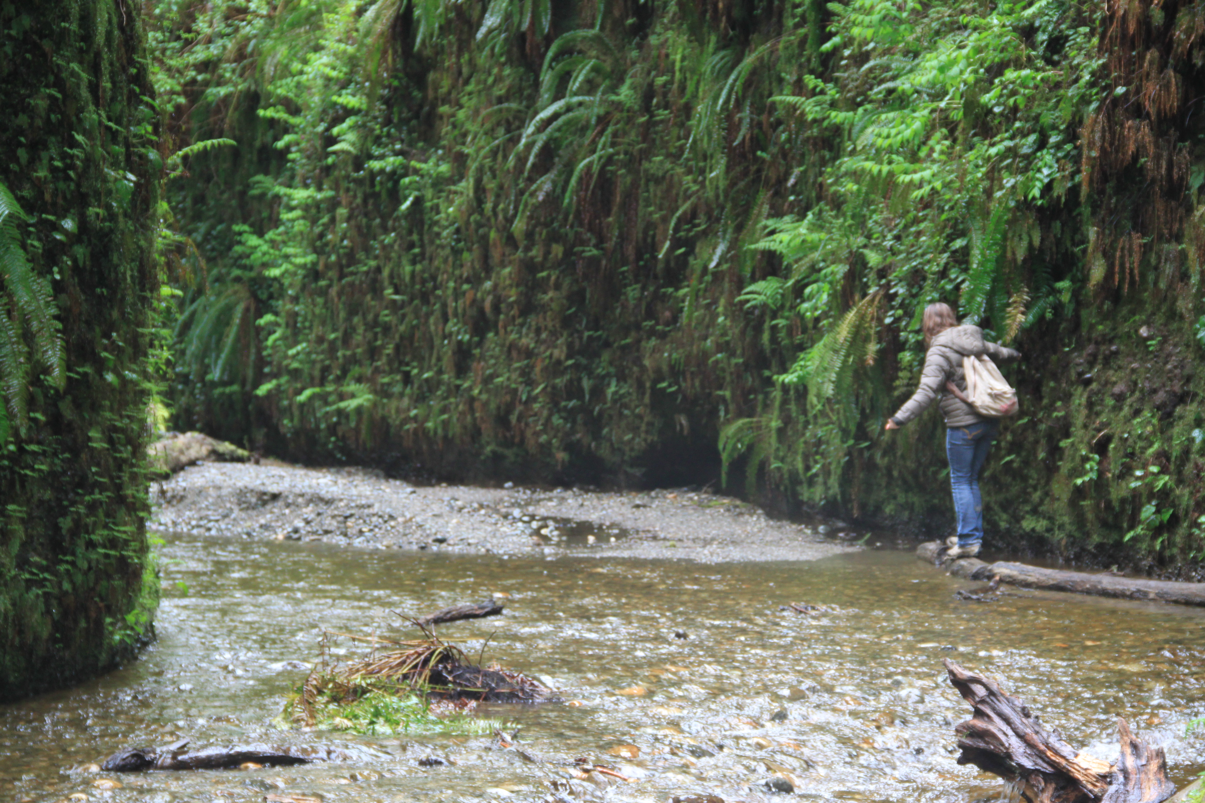
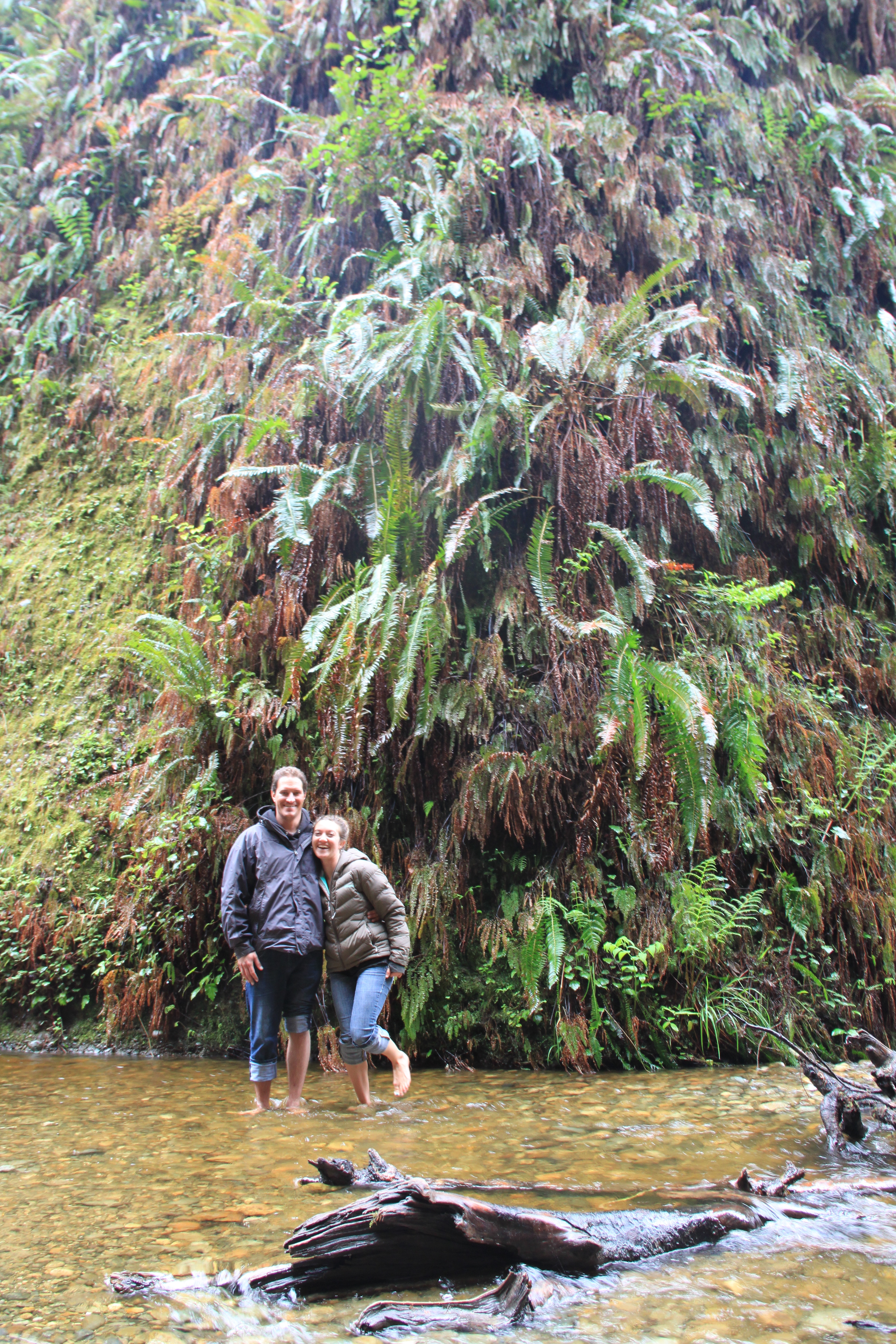
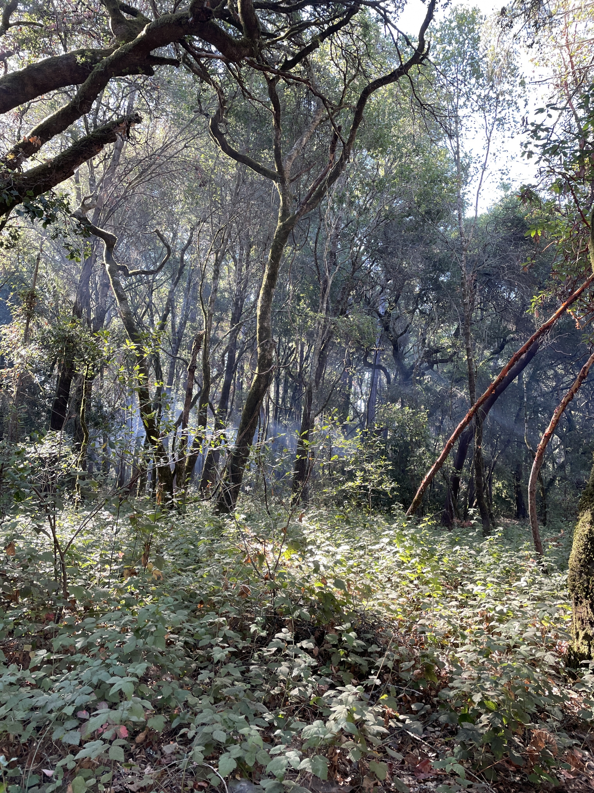
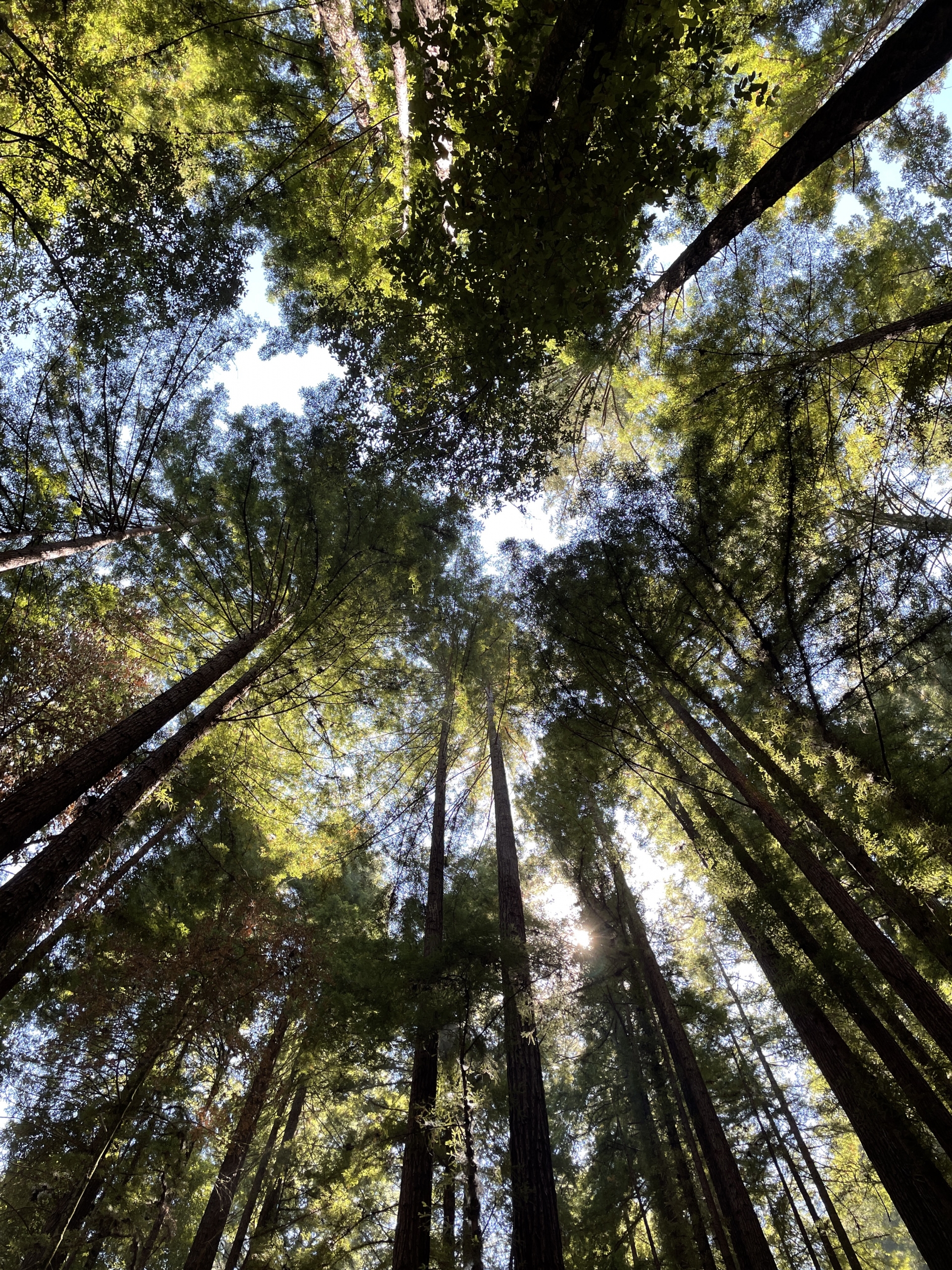
We made our way to Henry Cowell Redwoods State Park around 9:30 p.m. and set up camp. The next day, the surf was once again tiny, so we decided to hike around—albeit taking it easy with Lauren’s injured Achille’s. A mellow 6-mile hike literally over the river and through the redwoods was the day’s adventure—major picture porn ensued and my iPhone was a shutter slut. (see photo slideshow below)

The next day, we gave Steamer Lane a shot, although there wasn’t too much to be had. There were the occasional shockingly bigger sets and Lauren and I scored, under the approval of two local guys—one was a regulator named Carlos who told an errant kayak surfer (as nicely, but firmly as possible) to beat it. Thank you, Carlos!! We thanked him and struck up convo.

looking up into a tall redwood forest canopy

We’re surrounded.

On my first wave, I forgot kelp is a thing up there and inertia got the best of me when my board stopped short. The most epic wave of the trip was Lauren’s…she decided to trunk it AND wear her most awesome hat. Besides the fact that she looked like she belonged in Southern Baja, she took off on one of those “bomb” set waves and her hat nearly flew off as she cruised down the face and I paddled up the shoulder laughing hysterically. Thankfully she saved it, otherwise it was going to be my rescue mission. I must have died laughing. Best. Wave. Ever.

two girls standing in a forest making funny faces

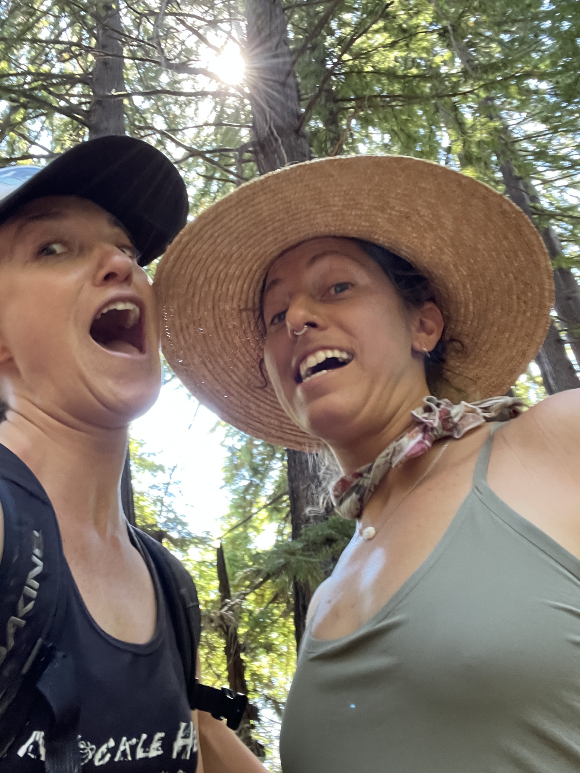
This hat is legendary.

Not long before—I saw a sea otter pop up right beside me, an inquisitive look on its face and a small spider crab on its tummy. I dazzled and gushed with joy while it stared back and proceeded to crunch loudly on a spindly little crab leg. According to the two local guys, a momma sea otter has been hassling and biting folks out in the lineup lately–they think it’s because she has babies somewhere.

small waves breaking off a cliffside on a. sunny day

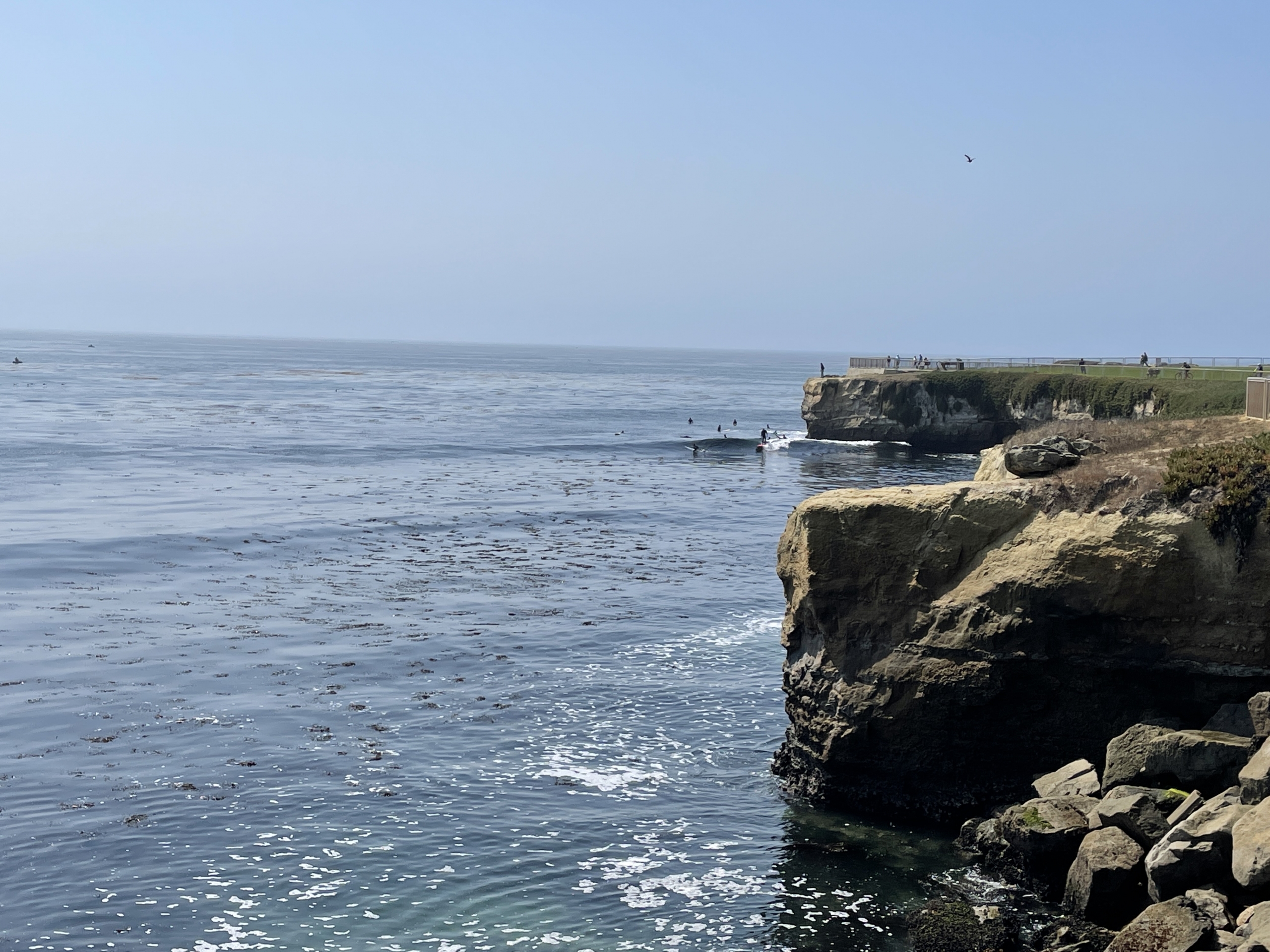
Steamer Lane, small and uncrowded.

While small waves hugged the cliffside and I waited my turn, I marveled at the rock layers and the sea stars, barnacles and kelp. What a perfect day for a snorkel or free dive! Best session of the whole trip, hands down. We made another attempt to surf 26th Ave, a nearby beach break, and though the waves were pretty much shore break, we found the best sunset views. A campfire, a solid burrito, a bottle of red wine and s’mores called us back to our campsite.
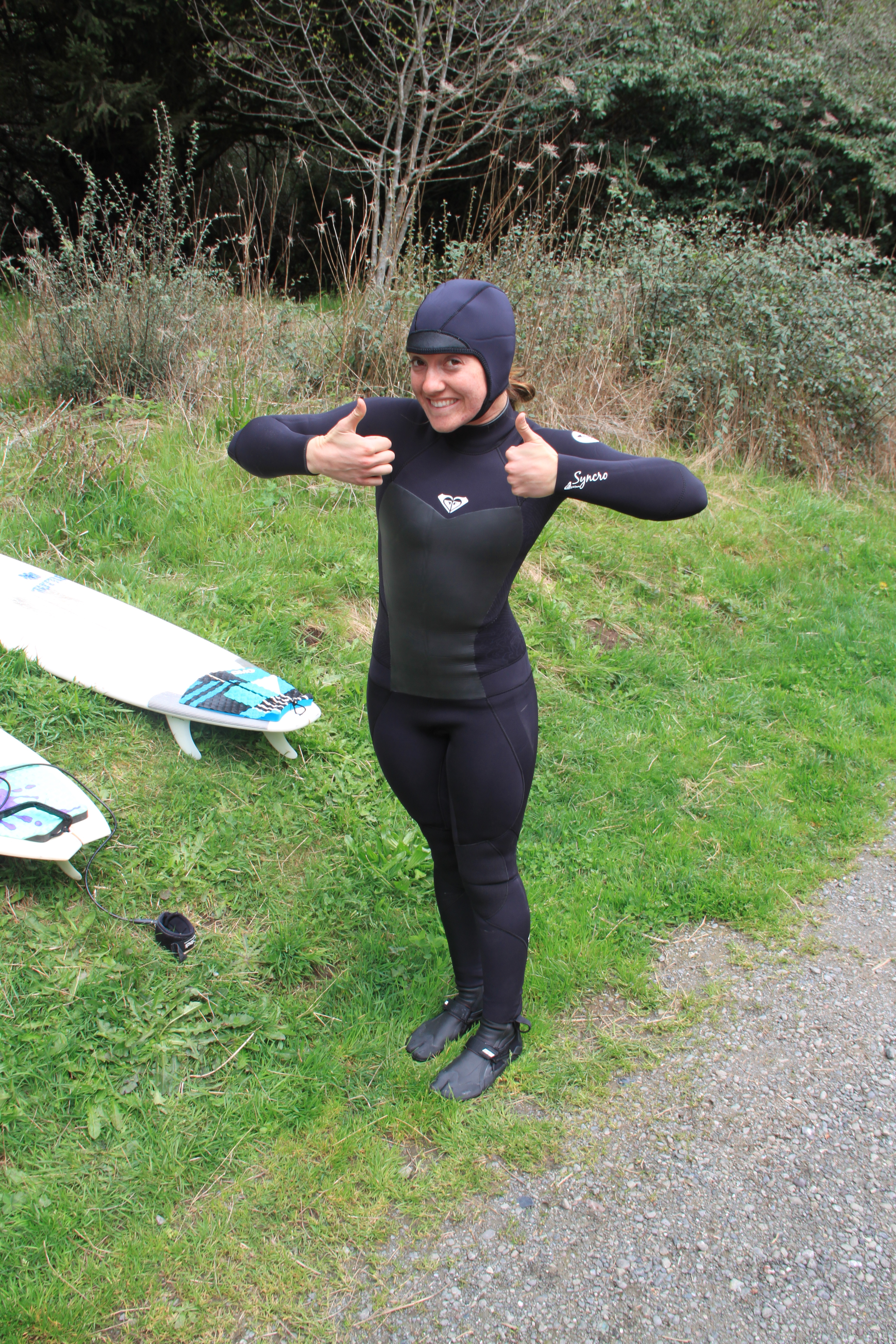
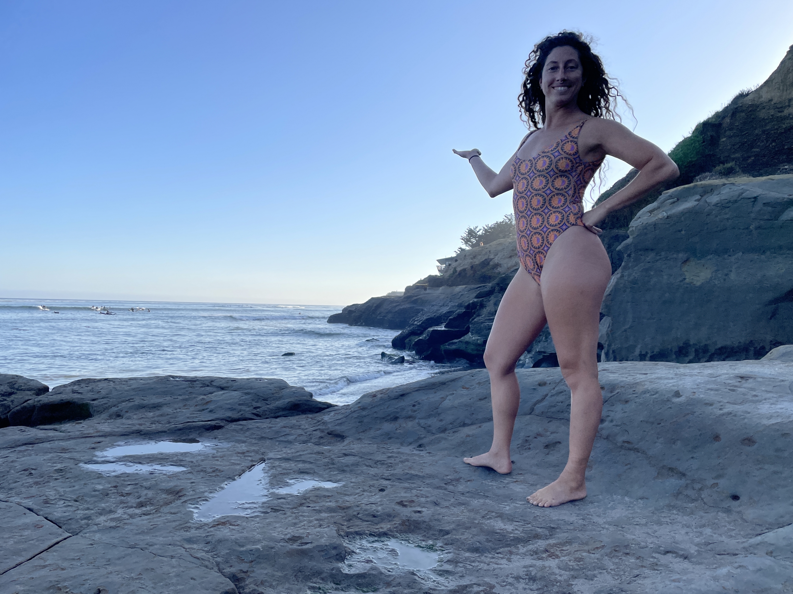
a girl wearing a bikini running out of the ocean with her hands up and smile on her face during the sunset

Trunkin it proof.

We made a few friends, too, who shared their biking adventures and we traded surf, bike and camping stories for our last night in Santa Cruz.

The morning was met with a hot dog from older hippie ladies by the Hook and some absolutely DELCIOUS pastries from Gayle’s Bakery based on Lauren’s recommends. We also did a stint at Grey Bears Thrift Store, and jetted as fast as my subie could carry our fat asses south towards Carmel, Monterrey and Big Sur aiming to find a camping spot. We checked some surf spots in Carmel, nothing too exciting, and dedicated our mileage to Big Sur.

Bixby Bridge in Big Sur California with fog and the beach

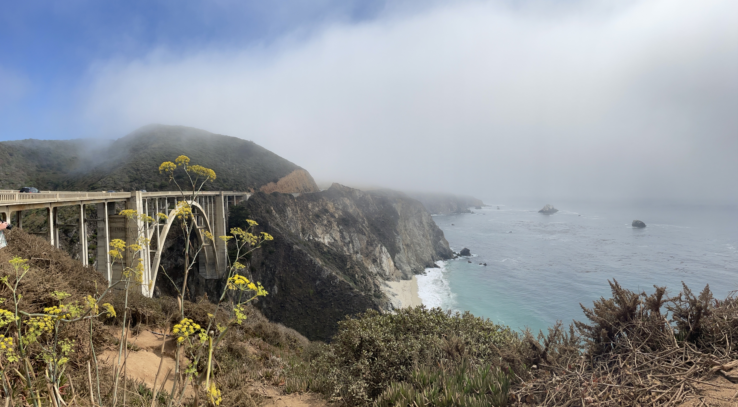
Obligatory pano of the Bixby Bridge. Not too shabby shot after tourist dodging, if I do say so myself.
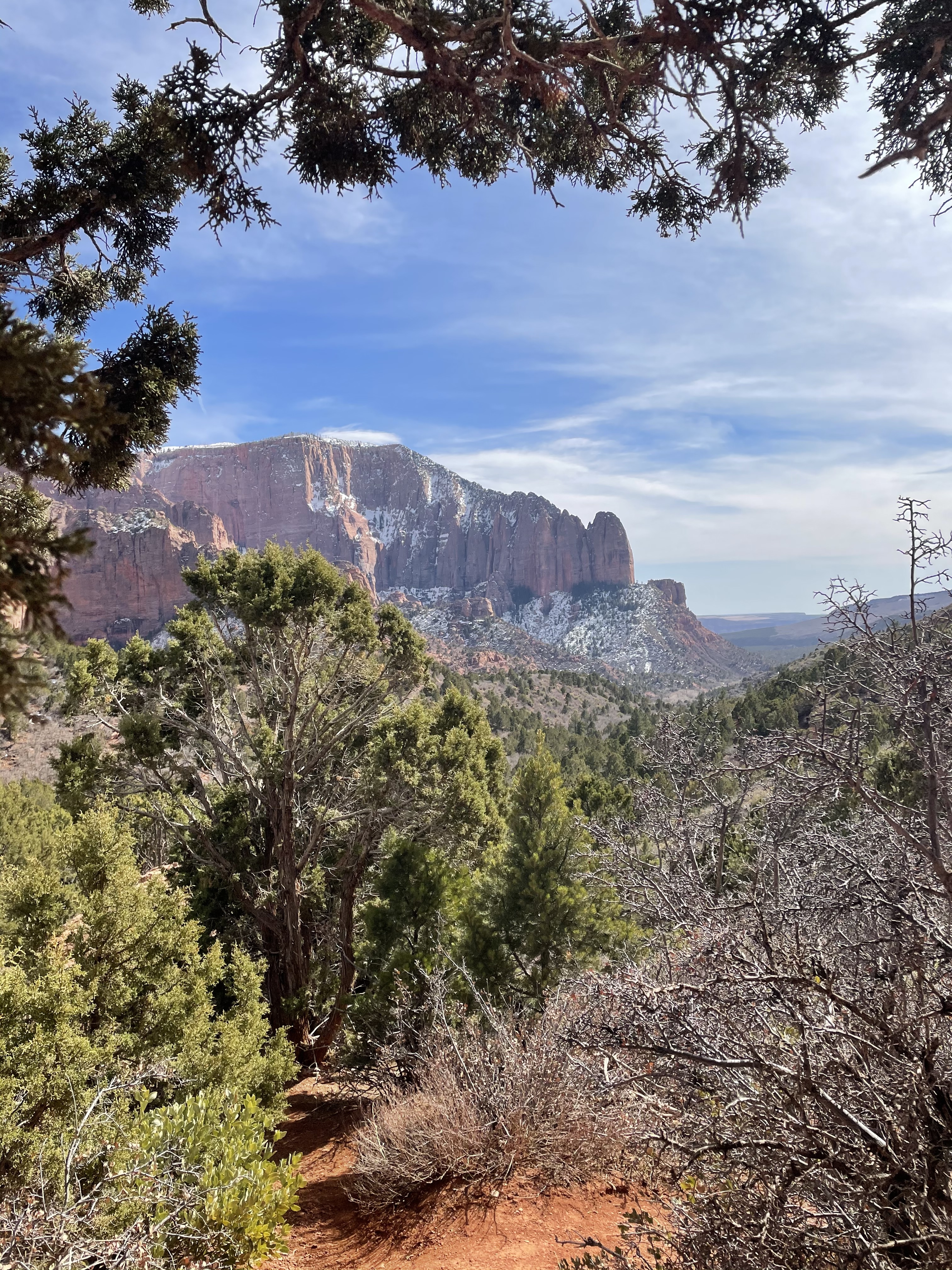
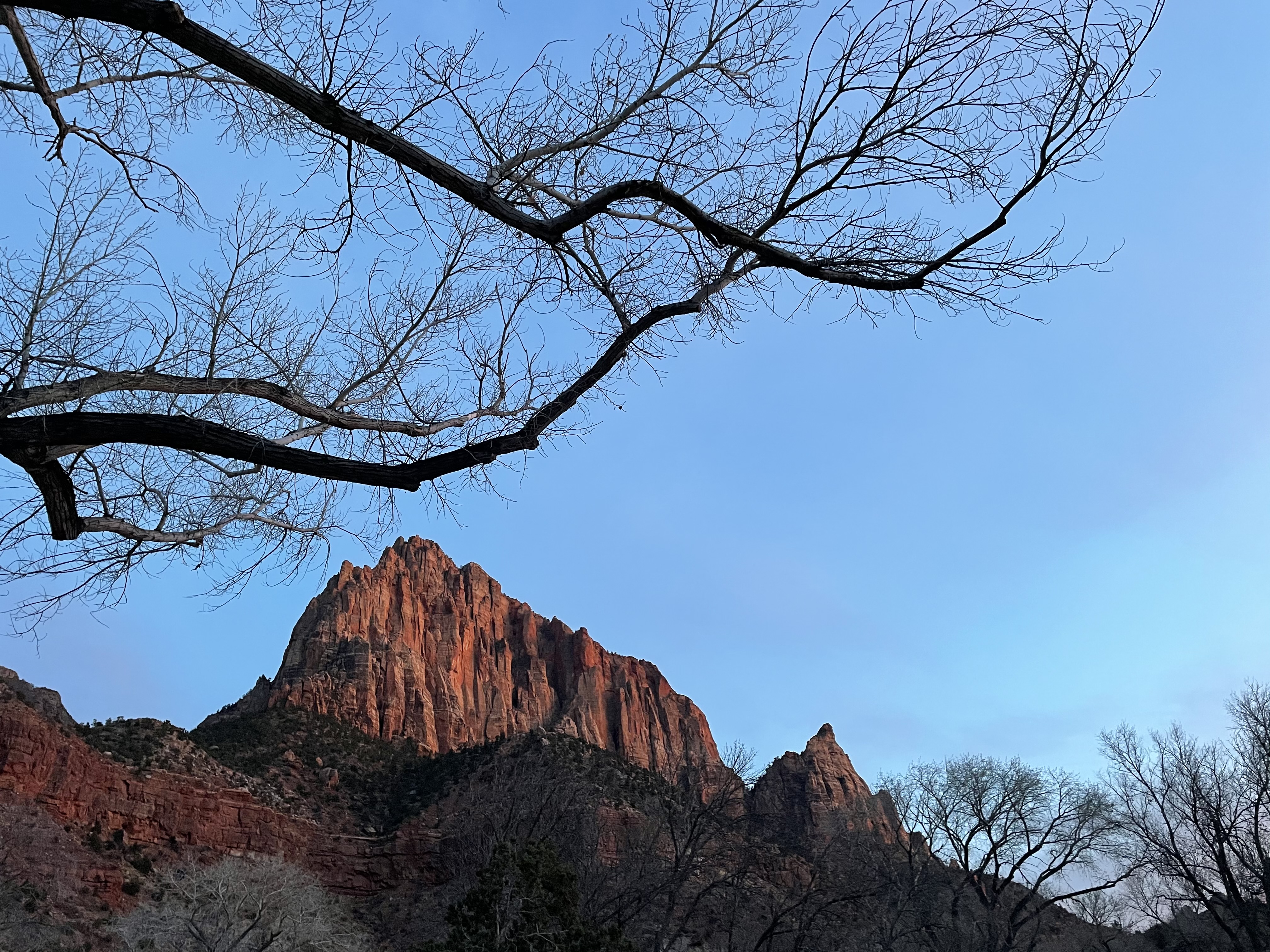
secluded beach with rocks and windy conditions in a partly cloudy sky

Pfeiffer Big Sur

Winding in and around PCH, Lauren chauffeured and I got to marvel uninterrupted at Big Sur’s incomparable beauty for the first time. Lauren was a trooper and let me do the tourist thing of taking 10 thousand pictures at Bixby Bridge. Tourists gathered inches away from the cliffside to take group photos at this historical site while I gingerly snuck around for an uninterrupted angle.

We stopped at Andrew Molera State Park and after realizing we’d have to hike our stuff into camp, we opted to find easier grounds. Ironically, we staked a claim at Pfeiffer Big Sur State Park—the spot where we were supposed to start a mini-backpacking trip. Our site was covered in leaves, a perfect critter notification system, I thought.

a girl wearing a headlamp tends to a campfire

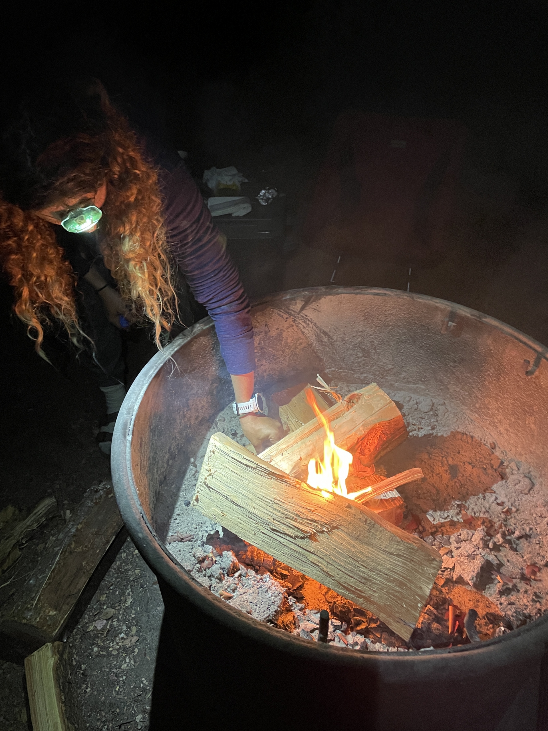
We tried to summon The Doors’ ‘Light My Fire,’ but phone signals, ya know…

Night time crept in swiftly as the tall redwood trees darkened the campgrounds with their immense shadows. Building the fire proved to be a challenging effort and as food and drinks fizzled into s’mores and laughter, we could sense critters creeping in around us. We peered into the darkness outside our campsite and sure enough, eyes dotted the dark like stars poking through a black sky. Raccoons…we hope.

Didn’t help I told Lauren about my mountain lion encounter from 2010.

All night long, I heard animal shrieks and leaves crunching right outside my tent—raccoons, surely. Some time around 4:00 am, I heard a dog persistently bark and growl and at 7:00 am, a shriek and some scattered leaves came from Lauren’s tent. Eventually I woke up to find her calmly reading a book and then told me about this blue bird who took her by surprise. I think the animals were extra curious. Perhaps we smelled like s’mores and dirt.

a wetsuit sitting on a rock with a large spider crawling on top of it

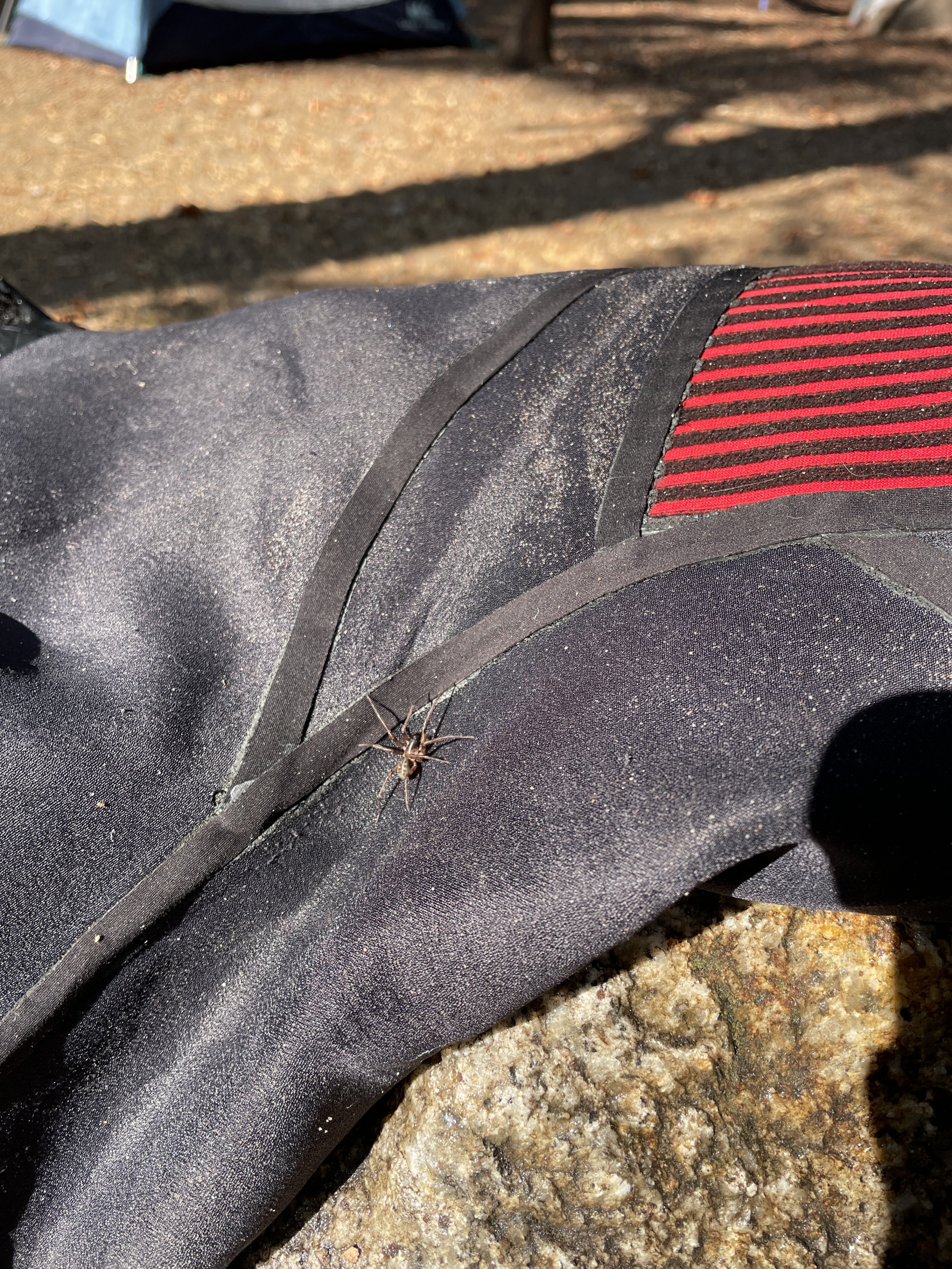
A small critter makes itself at home on my wettie. 

The last day of our trip began with a search for a surf spot recommend from my friend Royce Fraley, but fog and zero Wi-Fi wouldn’t allow for it. Next time.

We checked another surf spot recommend–Pfeiffer Big Sur, and had our own stretch of beach all to ourselves. There was what looked like a right breaking off some rocks and I paddled out to investigate, but the solo mission plus the random rocks and super sharky vibes had me coming in after a few duck dives. I once heard of a man who duck dove and never came back up.

foggy and rocky coastline with a peaky wave breaking off shore

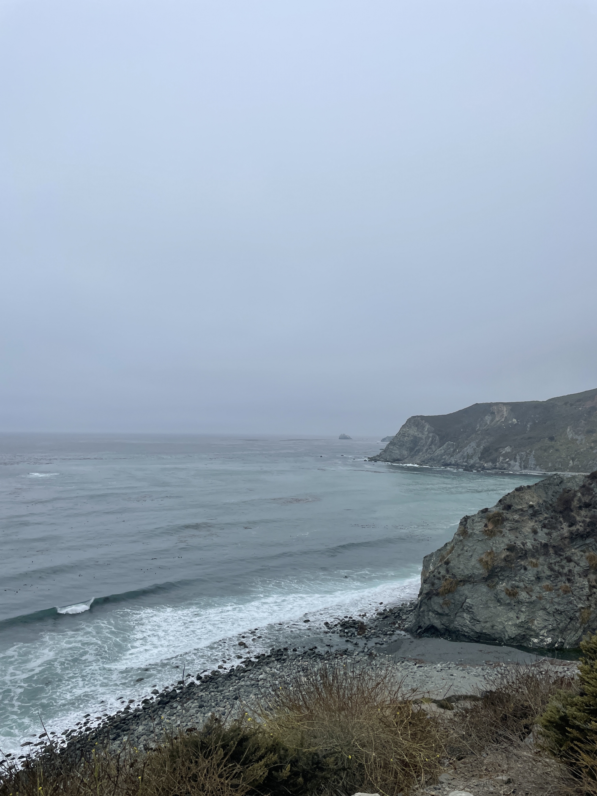
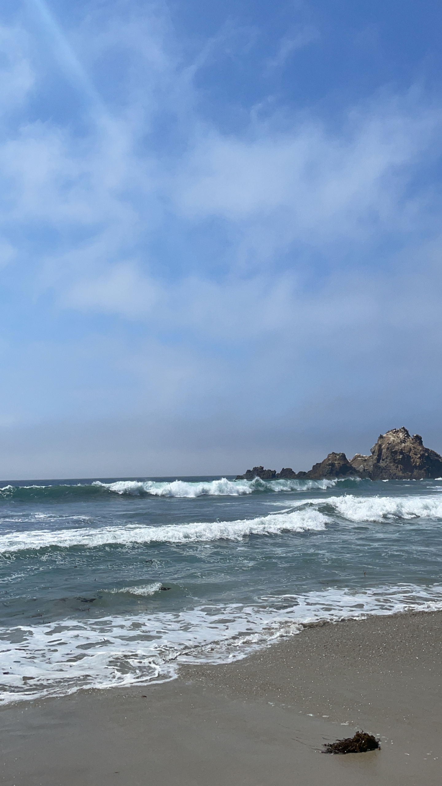
Would you go? Willow Creek looking peaky and tempting.

I later told Royce who joked and said I needed a guide. True. Laughing I thought—I just need a few more bodies out there to lessen those odds. Imagine that—I actually WANT people in the water with me…. well, a few…my friends only, but not as Great White snacks. Maybe that’s why that other spot he recommended was so territorial.

Eventually up and at ‘em again—we left our secluded slice of pre-colonized California and decided it was time to head back to reality. The pangs of anxiety rang to the tune of work, school and fur child, so I soaked in every hippie dippy, nature-induced high possible, like an addict savoring the last hit.

Lesson: Find more time to become un-notifiable.


More photos + videos:

Santa Cruz + Big Sur

tent under a bare tree in Utah

5 Camping Mistakes I Made in Zion and Why

trees framing the outlook to Kolob Canyon

Kolob Canyon overlook

Not every trip is full of sparkly images of you living your best life. Flights get canceled, surf or snow doesn’t show up, we mistime, we plan too far ahead or not enough, oh and this pandemic thing…we fuck up, we make mistakes and rarely do we admit it publicly…and we should more often because our lessons might help others.

What normally I reveled in for the past several years (camping, nature, snowboarding, etc.) became a trip full of “damn why didn’t I think of thats!” In case you haven’t noticed, for the past couple of years, I’ve been camping at Zion National Park and have been soaking up the challenge of conquering my fear of heights by hiking Angel’s Landing and recently made it a point to stop by Brian Head for a snowboarding session.

I think in between the recent death of someone falling off of Angel’s Landing on the same day and getting bad dizzy spells while hiking Angel’s Landing for my third time, I began to realize…I need to calm down. :D

But don’t worry—I’m not going to quit adventuring, I think this is one of those trips where there are lessons learned as opposed to goals achieved. I’m confessing my mistakes so you don’t do the same things I did:

girl with braids and a beenie holds camera in front for a selfie

Quite literally-NOT a happy camper.

1.Sleep is essential. Get some at all cost!! I am the world’s lightest sleeper. A pin drop would wake me up. So when 40 mph winds came tunneling through the canyon, shaking and jostling my tent All. Night. Long, every night… I had a hard time with everything I did. It didn’t help that I forgot a pillow, so I bundled up my puffiest gear, but guys—a zipper or button on the face all night long doesn’t exactly feel or look grand the next day. Not mention my neck was tweaked all six ways of something special. The next day, I woke up and rode my bike 6 miles up hill to the Angel’s Landing trailhead and on other days, went hiking and driving to Kolob Canyon and drove for 1 1/2 hour to snowboard. I can say-because of lack of sleep, my motivation and patience was at an all time low, like I had never seen before. Not a good feeling to have.

bike, firewood, snowboard and camping gear all piled in the back of a car

If you look close enough, you can see a kitchen sink.

2. Check your gear. The normally free Zion shuttle was charging $1 for rides and you have to book in advanced to get a ticket. Each day was completely booked and full, but I will add that you can find tickets at the last minute, but my phone didn’t have a great signal, so I brought my bike.
I didn’t know until I was about a mile biking into the canyon on the Pa’rus, but my tires were flat and I was beginning to wonder why I felt so out of shape. Fortunately, I met this nice couple on the trail & they kindly filled up my tires and, already winded, I was on my way a lot faster. It really is a beautiful ride, I highly recommend, but make sure to bring proper gear, like a bike pump.

3. Hydration. Hydration. Hydration. Sometimes when it’s colder, we might forget to drink water, but it’s imperative to do so, especially if you plan to do a strenuous bike/hike and it’s a desert climate. I was so focused on getting to the trailhead, I also forgot to drink water.

It was late in the day when I finished my 6-mile bike ride & started at the trail (around 11:00 am) and there were a crapton of people. No sleep combined with minimal water and beautiful nature distractions and my literal insatiable determination had me sending one foot in front of the other up the trail. I wanted to get to the top of Angel’s Landing around 1:30 so I could eat something. Why didn’t I eat something before hiking? The crowds + stupid COVID were making me nervous, so my mind was focused on completing the trail and catching the views…and eating my tasty sandwich at the peak, of course.

waterfall and a tree hanging over the water

Don’t drink the water! The beautiful Virgin River ain’t too pure, lots of signs everywhere warning you why.

By the time I got to the beginning of Angel’s Landing (the last quarter mile of the West Rim Trail), I heard that someone had fallen off that morning and died and they just reopened the trail. I still went for it. Fuck it. I thought. I think my mentality wasn’t all there because I was pissed off at the world for the unimaginable crowds, the pandemic and the poor person who fell off that morning. Fuck it fuck it fuck it. I’m going.

Mindlessly, I proceeded down the spine and clasped the chains. Not shortly into my climb, I slipped and went a-sliding and made a family totally panic. (Sorry, guys) and still thought -fuck it. I continued to go forth, my nerves making me forget to drink water. Even though my stare was mostly straight forward, I still got dizzy with head rushes. By the last couple hundred yards before the official peak, I got so dizzy, I had to sit down. And yea, I was in between hyperventilating and tears when this lovely gal from LA who was climbing behind me, immediately came to my rescue. She sat with me and gave me some electrolyte powder, which I straight shotgunned into my throat and immediately felt like I was foaming at the mouth. Her and her group adopted me and I was so thankful they did. So, nice folks in LA DO exist. :) Before my 6-mile bike ride back to camp, we all shared some margaritas and stories, hydration be damned.

rocks in Utah

Rocks stand high in the sky, you know how I feel…

4. Eat real FOOD. Maybe I haven’t gotten this camping thing down 100 percent, but I brought dehydrated meals to save on space and to get what I thought was adequate protein. I also brought fresh fruit and snacks for daaaays and plenty of protein bars. After day 2 of dehydrated meals for dinner as well as snacks, sandwiches and fruit, my body wasn’t having it anymore. I couldn’t make myself eat any of my stuff, honestly because all I could think about were eggs, hash browns, bacon and toast with tea or coffee. As I left Zion, I got exactly that at Oscar’s Cafe in Springdale and I could feel my body doing a little happy dance in between bites.

girl with sunglasses and a backpack smiles under red rocks

Don’t ask how I mustered that smile. All along the Watchman Trail.

5. Check yourself before you wreck yourself. With closures far and wide and the confines of stay-at-home orders, businesses biting the dust and extra safety protocols for public spaces, people are longing to get out and literally breathe fresh air …without contracting covid, of course. With all this pent up energy, I think I got ahead of myself and forgot to pause and check my mentality before pursuing my annual Zion + snowboarding trip. I was so focused on getting away and getting out…just like everyone else. And my expectations of low crowds, beautiful scenery and adventure did not match the pandemic reality. Crowds were aplenty and I’m trying to learn patience with people and the pandemic times while also looking at what I want out of trips versus what I will actually get.

My normal positive mental attitude wasn’t 100 percent there, in case you can’t tell. :D Signs of the times were everywhere, including not only the one death but another suicide at Angel’s Landing earlier that week, crazy crowds like I’ve never seen and constant roadblocks that never used to exist. In hindsight, which, ironically, is always 2020 (haaaa), I should’ve just hiked past Angel’s Landing, found a way to get better sleep and made more of an effort to hydrate myself and eat real food.

mountain slopes covered in snow

Brian Head Resort in Utah cooled off my hot head.

Snowboarding, on the other hand, was my one saving day and had me leaving southern Utah with a very tired smile.

Hindsight…Maybe we can change that “hindsight is 2020″ thing…


It wasn’t ALL camping mishaps. Check out a few more photos from Zion, Kolob and Brian Head in my album below!

Utah 2021

And a long compilation of my videos from Zion to Kolob Canyon and Brian Head, too:


Peak 6 of 6: Mount San Gorgonio

The grand finale peak had me so very proud…

Sunrise view is so necessary

The Hike:

This is the tallest peak in Southern California towering at 11,503 feet. It is also the longest trail clocking in at 17 miles roundtrip. You should always take careful precautions for any trail, but this one requires a lot of time if you’re on the slower side, like me.

The trail begins with an easy stroll on a straightaway path, Once you cross the large granite riverbed, you arrive at the switchbacks, which are steep and difficult…probably one, if not, THE most difficult part of the trail.

Along the way, you first pass Vivian Creek Camp, which sits at 7,100 feet and shortly after that, you come to Halfway Camp, which is at 8,100 feet. These are located in beautiful, picture-worthy areas, although I did not get to take many photos. This time around I was with a group who was moving quickly, but stopped when I needed to rest.

At 9,200 feet the trail starts to become rocky and a little less shaded, wear that sunscreen! You’ll keep climbing and THINK you see the peak, but no. This happened to my co-worker and I, where we were faked out at least twice, a gut-wrenching disappointment once you can finally see ant-like people traversing across a rocky path towards a peak even further away.

Pano moment

Once you reach the peak, you can see far and wide views from Palm Springs to Big Bear Lake, the desert, the city, more mountains to explore.


Almost there…

Driving Directions: Turn east of off highway 38 to Forest Falls. Continue through Forest Falls to the top end of the Falls Picnic area. Parking is located at the end of the road.


Parking: Good luck! Most parking is taken up by 6:30 a.m., but there is a separate lot below the smelly restrooms. It’s kind of a cruel joke when you are done with the trail.

Roundtrip mileage: 17 miles, 12 hours

Elevation: 11,503 feet

Elevation gain: 5,484 feet

What to bring: At least three liters of water, electrolyte drink, snacks, sunscreen, patience, a smile, a little toilet paper—this will take ALL day

Consider this: This hike is a royal ass-kicker, not because of the steepness like Baldy, but because it is so long. For the most part, the hike is a relatively gradual climb, but there are times where the elevation gets to you and, much like Baldy, you begin to question your sanity. THERE IS NO SHAME IN TAKING BREAKS. I did and often, especially towards the top. It is a good idea to hike a trail that has similar mileage and elevation so you’re not completely blindsided. Baldy’s 13-mile West Rim trail worked nicely for me and took me 2 hours shorter than this one. Be patient with yourself, but know your limits.


Peak 5 of 6: Mount San Antonio, a.k.a. Mt. Baldy

Peak five out of six had me wishing for wings on my shoes…

The Hike:

There are several different trails headed towards the highest peak in the San Gabriel Mountains, however, I picked the West Rim trail, also known as Mt. Baldy Trail #7W12, which is 6 miles one way to the barren peak. Park along Mt. Baldy Road near the visitor center and head down Bear Canyon Road where you’ll walk past a church and a neighborhood of mountain dwelling folk. The trail starts at the end of Bear Canyon Road where you’ll be welcomed by a beautiful bubbling stream and thousands of mosquitos and gnats. For the first 1.6 miles you’re hiking through heavily wooded areas with a fairly easy-going gradient. Once you reach Bear Flat, the trail will appear as if it’s forked. The trail is not incredibly obvious, so bare (ha!) in mind: to continue on the trail, you’ll want to hang a left where you’ll briefly cross a stream and head into a meadow. Signage was rather poor on this trail, so be sure to stay alert.

After the meadow, there is a series of steep switchbacks that warms you up for intensity of the trail. The switchbacks are lined with mostly scrubs, like chaparral, sage and clover patches. Beware of the bees humming along in the clover patches. If you are allergic, it would be wise to bring an epi-pen as a precaution.

One word: Steep.

Once you’ve conquered the switchbacks and have reached about 7,000 feet, there are several shady spots, thanks to the Sugar Pines and White Fir trees. Following along the steep path, you slowly start to think about turning around. Unless you run out of water, don’t do it. Keep going.

Eventually, you reach a large natural depression in the landscape where you can find some shady spots. Re-apply that sunscreen! Following the trail, you’ll reach the west ridge of Mt. Baldy for your last leg—a fairly forgiving climb comparatively.

Reach the top and celebrate! You just climbed the highest point in the San Gabriels. Soak it in. Feel badass because you ARE.

Not the widest path

Driving Directions: From the 210 east towards San Bernardino, exit Base Line Drive, make a right onto Pahua Drive and a right onto Mount Baldy Road. Park along the road and walk towards the old church located on the right side of the road, walk through the neighborhood and eventually you will find the trailhead—one of THREE signs you’ll see along the way. Stay alert.

Parking: Park alongside the road where available. I would not recommend parking in the church lot, although people seem to do it anyway.

Roundtrip mileage: 13.2 miles, 10 hours

Elevation: 10,064 feet

Elevation gain: 5,650 feet

What to bring: At least 3 liters of water, electrolyte tablets, snacks, hat, A LOT of sunscreen, phone/camera, mental sanity

Consider this: Bring all the water you think you need. This trail will push every ounce of brain you have. Just when you think you have the peak in your sights, the trail fakes you out and you’ll keep climbing onto an even steeper trail section than before. Frustration may kick in to a point where you question your sanity and safety. If you feel the need to turnaround, there’s no shame in that. Know your limits. But, if you remotely think you can handle it, DON’T GIVE UP.


Peak 3 of 6: Cucamonga Peak

Peak three of six had me second-guessing that I was actually still in Southern California…

Beautiful redwoods dwarf any palm tree.

Beautiful redwoods dwarf any palm tree.

Taking in all the hobbit potential...

Taking in all the hobbit potential…

The Hike: By far one of my most favorited hikes during this challenge. For the first 2.6 miles, you’ll be hiking the Icehouse Canyon Trail, which features beautiful lush foliage alongside a rushing creek. There are also cabins and cairns to ogle at, which make this place look like anything but Southern California. Eventually you’ll make it to a rock quarry-looking area where you can observe very interesting geological rock formations. But don’t get too distracted—it’s easy to lose the trail. Veer towards the right in this quarry-like setting and you’ll come to the 2.5 miles to of the first chunk of the trail, which takes you through more exposeswitchbacks and eventually to the “Icehouse Saddle.” It is during this portion of the hike where you will climb the most elevation as the saddle puts you at about 7,600 feet.

Once you get to the saddle, you can go one of three different routes. I completely geeked out because not only could I see a beautiful forest view into the valley, but I also found more trails/mountains to hike.

Signage will point you straight onwards for another 2.4 miles towards Cucamonga Peak. This trail has a lot of loose gravel, and due to frequent landslides, the gravel often covers up the tiny trail itself. This makes things slippery, so proceed with caution.
And just like this hike description, when you think it’s never going to end, it does. And the view of the inland empire and Apple Valley is spectacular. If there are clouds around, they tend to make your photos look pretty damn cool, too.

Driving Directions: From the 210 east towards San Bernardino, exit Base Line Drive, make a right onto Pahua Drive and a right onto Mount Baldy Road. The trailhead is located at the end of Mt. Baldy Road, and there is a lot for those who have Adventure or National Park passes. You can also park alongside the road without any ticketing consequences.

Back in the day, California was filled with volcanoes...still was a hot place to be. ha! I'm here all night.

Back in the day, California was filled with volcanoes…still was a hot place to be. ha! I’m here all night.

You'd walk right past it and never give it a second thought, but don't forget to check out the old gold mines.

You’d walk right past it and never give it a second thought, but don’t forget to check out the old gold mines.

Roundtrip mileage: 15 miles, 8 hours

Elevation: 8,859 feet

Elevation gain: 4,000 feet

What to bring: Water, snacks, hat, sunscreen, phone/camera, Adventure Pass

Consider this: There are so many cools sights to see along this trail that you tend to forget to sip your water. Cabins, cairns and igneous rocks can easily distractify, but don’t forget to do a sanity check lest your lungs do it for you. Also, be sure to look for the old gold mines along the trail. There’s no signs that point them out, they’re just kind of chillin’, so be on the lookout. If you’re heading toward the peak, they are on your right…because to your left is a straight 1,000 foot drop.


Peak 2 of 6: Sitton Peak

Peak two of six made me consider bug spray! Just when I thought it was safe to wear shorts and a tank top…

The scrubby trail to Sitton Peak.

The scrubby trail to Sitton Peak.

The Hike: A local peak always sounds great, right? Find the Bear Canyon trailhead located behind the old -fashioned Candy Store off Ortega Highway. It’s easy to miss this trailhead, so if the store is open, there’s no shame in asking about the trail location. The store also offers free printed maps. This trail requires a wilderness permit, which is often available at the trailhead to fill out. If not, bring a pen and paper and leave your info in the box.
The hike begins at a moderate pace and is lined with brush and large boulders. It meanders over a creek where there are plenty of trees for shade, although there isn’t much shade elsewhere on the trail. Since there are some areas that appear to be overgrown, I was getting mountain lion vibes, which reinvigorated my machete desires. Since I was sans machete, I sang Yankee Doodle very loudly and made lots of noise as well as carried a walking stick and a rock.

The last portion to the peak is almost a literal climb. At first, it didn’t even appear to be an actual trail since it was pretty steep and looked washed out, but it is and your calves will thank you for the luscious workout.
I started around 10:00am, made it to the peak by just before 1:00pm and back to my car at 3:00pm. Why so fast? Two words: The bugs.

Simply titled Candy Store and Goods off the 74-Ortega Highway. Park across the street.

Simply titled Candy Store and Goods off the 74-Ortega Highway. Park across the street.

Driving Directions: hop on the 5 freeway and exit Ortega Highway (Hwy 74), head towards Lake Elsinore and keep going until you see “Candy Store and Goods.” Park in the national parks parking lot across the street from the store and either pay for parking or display your Adventure Pass. Carefully walk across the street.

Parking: located across the street from the candy store–no parking at the candy store

Roundtrip mileage: 12 miles, 5.5 hours*

Elevation: 3,273 feet

Elevation gain: 2,150 feet

Not sure how I made it without going insane, but I made it!

Not sure how I made it without going insane, but I made it!

What to bring: Adventure Pass, POWERFUL BUG REPELLENT that doesn’t give you cancer, lots of water depending on the air temperature, food, hiking stick, some form of mountain lion defense, courage

Consider this: The bugs are absolutely relentless. If I stopped for longer than 2 minutes, those suckers were on me like, well, flies on meat…that was sweating…because my dumb ass decided to start my hike at 10:00 a.m. Both factors made the hike less enjoyable. For almost the entirety of the hike, I was eaten alive by mosquitoes and horseflies. Have you ever been bitten by a horsefly? They SUCK! And leave big red welts that take too long to go away. The first part of this hike is shrouded in foliage, trees, rocks…lovely vantage points for mountain lions to sneak up on you. I didn’t see any, but it was definitely on my mind since I had a run-in with one 10 years ago in Carbon Canyon.


Taking in the views of the Cleveland National Forest.

Taking in the views of the Cleveland National Forest.

A Journey on the Pacific Crest Trail with Sean Jansen

Sean Jansen is a rare human being who delights in the most amazing and intimidating of experiences. From driving solo to the further outreaches of desolate Baja coastlines to braving Northern California’s frigid large surf, to taking off for years on end to travel the world, he’s always got an adventure up his sleeve–which is why I didn’t flinch when he told me about trekking the ENTIRE  Pacific Crest Trail.

Born and raised in San Clemente, California, Jansen grew up surfing San Clemente’s wide variety of waves and absorbing the beach culture lifestyle. He currently enjoys chilly surf breaks, incredible nature preserves and a solid Eel River IPA about 950 miles north of his hometown in Humboldt county. Since a Lower Trestles session in 2010, he’s been a good friend of mine and has continually motivated me to surf harder, go outside of the proverbial orange bubble and enjoy nature.

According to the Pacific Crest Trail Association, this infamous PCT stretches 2,650.10 miles from Mexico to Canada. PCT spans across mountain ranges, valleys, deeps forests and deserts–a photog’s dream for pictures a-la National Geographic.

To no surprise, Jansen hiked 131.06 miles beyond the calculated amount: 2,781.16 miles.

I recently caught up with Jansen about his hiking journey of epic proportions:

1.) What made you want to hike the entire PCT?

It was kind of like a culmination of a bunch of things.

I was living with my parents in Montana and was working construction saving every single penny. Within three months, I had saved several thousand dollars saved and had the option to go travel again, but I was kind of bored of traveling, as weird as that sounds. I wanted to do something different. A friend posted on Facebook that he was going to hike the PCT and that kind of re-invigorated my desire to want to hike.

I think it was just going to be an awesome thing that would further push my career to a higher level as a photographer and journalist. I can only imagine the images I would be able to capture if I were to be in nature every single day while experiencing the beauty the Lord has blessed us with on this planet. I think that’s the number one reason—just to get away from everything and go experience nature out there beyond highways, beyond jet planes–beauty that your own two feet can show you.

It’s your own will power to see the beauty that I’ve seen and that’s probably the number one reason.


2.) How did you mentally and physically prepare for this journey?

Mental preparation was really bad, I didn’t mentally prepare at all. My cousin decided to give us a ride to the southern terminus, which was only a 2 hour drive from San Clemente. My friend was getting all giddy in the car saying “Can you believe we’re about to do this?” and I’m just like “No, not really.”

It’s not that I wasn’t excited, I just wasn’t overwhelmed by the emotions of 90 percent of the people. It wasn’t until I woke up one morning on the trail and was like “Holy crap, this is actually happening.” And after I hiked the first 10-100 miles, that’s when it was really setting in. I  was realizing that I’m really out there and really doing this to see what I can really do.

The whole purpose of the trail was for me to learn every ounce I could learn about myself and the trail.  The mental and physical preparation was all a giant learning process. I would never change it to this day.


3.) What were some challenges you faced? Biggest challenge?

Every day was a challenge, mentally and physically. The trail was a challenge, because it changes every single day. You go from the desert, to the mountains, back to the desert, through snow, rain and wind.

You have to face challenges with other hikers–whether you accidentally fall in love with someone within the first week and you broke up with them and you have to keep seeing them. There were challenges dealing with friends that you got to know really well, but they decided they wanted to hike faster and took off and you never saw them again.

In every way you can think, there was a challenge. I kept saying the number one word of the trail was “change.” Everything about the trail and you changes with every step you take. You change personally, physically and the trail changes–so I can’t really pinpoint a challenge.

As photographer, I had to take off my backpack, pull out my camera (which weighed a couple of extra pounds), and put the camera back in the bag while everyone walks on. The photography aspect was my biggest challenge because:

1.) You’re carrying more weight and     2.) You have to get really creative. ……It’s exhausting, but it was worth it.


4.) Any close encounters with wildlife?
Yes absolutely—but I was never nervous or uncomfortable. You would hear stories about people who would have terrible encounters with wildlife—where they got charged at by a bear, for example.

In Oregon, well past dark, we always sleep with food inside of our tent. I literally had a bear scratching at my tent where my friend would’ve been. The next morning, there was fresh bear scat around my entire tent.

In Oregon and Washington, we would always hear Elk bugles ferociously close. That was probably the scariest of what we came across on the whole trail because once we got to Oregon and Washington, it was during their mating season and they’re notoriously territorial and aggressive.


5.) What supplies were you carrying along the way?

Beyond the fact that I’m a photographer and a fly-fisherman—I had a 65 liter backpack, which was overkill. It was way too big, which was a little surprising for what people think. One of my biggest concerns, before I started the trail, was where I was going to get water every day. So what you find out on the trail, was at least once a week, sometimes a little longer, you would get a re-supply of food because you would come across a highway or town.

In a typical backpack, you would carry food, tent, sleeping bag, sleeping pad, clothing, a lighter, cooking gear among other stuff.  The average pack weighed without food or water was about 20 pounds. Some of us even carried solar panels on our backpacks to charge our gear. I had my camera gear and two batteries, one lens, a couple of filters and a tripod, which was an additional 7 pounds.

At my heaviest point, which was in the desert section where I carried 8 liters of water, my pack weight about 70 pounds. But as I drank water and ate food, my pack became lighter each day. Everyone else was in the 45-50 pound range.


6.) Any special secret spots you can talk about?

In the big bear area, there was this section of trail called the Deep Creek and a lot of us liked this because there was a hot spring. I followed a day hiker to a cliff jump spot, which was 200 yards off trail and I just ended up spending a day and a half there doing nothing but cliff jumping in 90 degree heat.

There was also lake with a waterfall along the John Muir trail section of the PCT that looked it was in either Tahiti or New Zealand—like it didn’t belong in California.


7.) What was your most memorable moment?

Of course, when you walk towards that northern terminus, seeing the border of Canada after hiking for 180 days straight—that is something I will never ever forget along with the people I did it with. I will never forget that.

It’s really just the small moments that create a giant memory. It changes your life, I get emotional thinking about it. There are so many small memories that create this giant pandemonium moment.


8.) How did your feet feel at the end of the journey?

As far as feet goes, the beginning section was rough because of the blisters and the new stage your feet are going to get into, then towards the latter section of the trail is where injuries occurred. I probably took a week off total.

The first month, every single day, I was popping blisters and covering them up with some sort of bandage. Towards the middle stage of the trail, I was fine, but towards the latter session of the trail, I started getting plantar fasciitis in Oregon—where the muscles in your feet just don’t want to work and you can’t bend your toes. It was very painful, but with a couple of days rest, ice and Ibuprofen, I was fine…and whiskey helps.


9.) Any epic life lessons you want to share?

Photo Courtesy: Sean Jansen

In retrospect, it’s really funny. I’m a total weirdo and I connected with every single human on that trail and all of us were weirdos, which worked out. We just didn’t care what people thought of us or about how bad we smelled in public. It was a huge life-changing opportunity, especially being from San Clemente, where in high school, image was everything. The whole trail was a life lesson, appreciation of everything—nature, yourself, other people around you.

10.) Do you foresee more long-distance hiking in the near future?

A lot more. In 2017, I’m going to do the Appalachian trail, which goes from Georgia to Maine.

In 2018 I’m hoping to hike the Continental Divide trail, which goes from Mexico to Canada. There’s a trail in Europe that goes from France to the Czech Republic. There’s definitely one in New Zealand that goes the entire span of the country.

Hiking is 100% part of my life now. Slow and steady is the best way to see the Earth.

Photo Courtesy: Sean Jansen

Check out more of Jansen’s PCT photos as well as tons of amazing surf, nature and travel pictures.

Boys will be Boys: Six Tips for Surfer Girls Traveling with Surfer Boys

It’s common knowledge that the mass majority of surfers in the lineup are guys. Okay ladies, let’s face it: the likelihood of an all-girls surf trip to Mexico is pretty slim. Don’t get me wrong, I’ve traveled to Mexico by myself, survived and loved it, however, not many of my surfer girlfriends are as eager to hop the border and rough it to find perfect un-crowded waves. Call me ‘crazy’ for going to Mexico by myself on my first excursion, call me ‘insane’ for the second trip with a bunch of boys. I don’t care. My end results were fun times with no regrets.

Testosterone is everywhere on a guys trip and every once in a while, they might think you’re cool enough to include in their boys club, but I don’t blame you if you re-consider and decide to wait until Mexico’s drug war has ended and kidnappings are at an all-time low.
But if you’re as impatient as I was and pale at the thought of empty points breaking without you, here are few tips about traveling with the boys:

1.) Let them be Boys
You are on this trip to surf and surf some more. They are on this trip to do the same along with all the beer guzzling contests, dirty jokes, burps and farts intact. Deal with it. Bodily functions are a-plenty, so if you have a weak stomach, perhaps you shouldn’t have gone on this trip. Bring a nose plug.

2.) Bring a good book or a pair of headphones.

Get ready for hair metal mixes, mass drunken sing-a-longs to a garden variety of rap songs, dirty jokes you didn’t know existed and fart smells that will fry your nose hair. Think I’m kidding? Think again, chica. But don’t be bitter, this is a boy’s trip and you’re, well, the minority. It doesn’t hurt to occasionally force-feed a little Cyndie Lauper down their throats, either. You would be surprised by the music middle ground you can reach with a group of guys. Who knows? There might be a closet Taylor Swift fan among the group.
But there are times when those dirty jokes or fart noises can get out of hand. Tired of hearing Metallica’s ‘Creeping Death’ for the 10 millionth time? Remember to come prepared with your head gear equipped with your favorite tunes.

3.) Know Your Limits and Plan Back-Up Activities
If you don’t want to stay up for that third keg of beer or you’d rather not surf the spot swarming with seals, let your guy friends be their gnarly testosterone selves. Go for a hike, surf a different spot or take some ‘you’ time. After all, traveling with all boys might make you forget that you are, in fact, a girl. Celebrate all that is feminine while they hunt for bone-crushing barrels that break in inch-deep water. But if you can hang, go for it! You will only command more respect among the Y-chromosomed. Just try not to emasculate them in the process. But, know your own limits so they don’t have to cut the trip short due to your cute cocky self scoring a broken limb or head injury instead of a sick drainer.

4.) Stroke Their, um, Ego
Despite the over-stated machismo image stereotyped for surfer boys, there is a secret sensitive Sally whose feelings and ego can get hurt. Guys aren’t made of stone, so always stay positive and patient. Make them feel good about their attempt at breakfast or their supposed ‘sense of direction.’ Most of all, compliment their waves. Whether they’re ripping or taking dives over the falls, find something good about that ride. A little ‘yeeww’ goes a long way.

5.) Why Can’t We Be Friends?
If you intend to hook up with one of the guys, stay home. Putting that dynamic into the mix can add an awkward vibe to the trip and tends to create jealousy or resentment among fellow compadres. Be cool and try not to cloud a male bonding experience with your cute, um, assets. Keep your pants on. If sparks fly, try to wait until you’re in familiar territory. Besides, I bet he will respect you that much more if you play a little hard-to-get and show him that he’s not the center of your universe…for now.

6.) Laugh
Perhaps the most important point of all: laughter is key. Yeah, boys can be gross, smelly and downright annoying, but really, just laugh. Don’t deny it, your inner tomboy busted with laughter when your buddy chugged four Tecates then proudly belched his A-B-C’s. Unless you’re sitting in the U.S./Mexico border traffic, the ipod’s gone stale and your buddy continues to drink until he unwittingly trades his passport for more tequila which consequently shoves you’re crew into the secondary line, let it fly. Besides, I’m guessing if you’ve made it to the end of this article, you probably aren’t 100 percent girly-girl, anyway. Ain’t no smirking and mouthing ‘what an idiot’ to a home girl who’s not there! Laugh it off.

Five things you NEED in Humboldt:

Humboldt Redwood forests galore! Try to find the hobbit in this picture.

Humboldt Redwood forests galore! Try to find the hobbit in this picture.

Ah, the land of beards, flannel and weed connoisseurs! Humboldt, Calif. is an area of the golden state that is anything but dry and brown.  Noted for it’s beautiful temperate rainforest, rocky coastline and, well, all different types of greenery, Humboldt is not a place to pass up …or puff-puff-pass the day away. Go outside.

All rain and stoners aside, I drove the 950 mile stretch solo to visit a good friend, score some waves and hug some trees. It didn’t take any THC-induced revelation to figure out the five essentials you can’t go without. Ladies and gents, other than your paraphernalia, don’t forget to pack these:

Waterproof Patagonia Jackets rock!

Waterproof Patagonia Jackets rock!

1.)    Waterproof Jacket:

Despite the fact that the ocean is chilly and chances of a swim/surf or (whatever your fancy) are less than that of Hawaii, you will get wet. Loosely considered the Pacific Northwest, Humboldt is rainy place. The coast varies only 10 degrees summer-to-winter and has an average rainfall of 40-100 inches per year. Coupled with humidity, this can create some wet (and not too cold) conditions. I was recently converted to Patagonia’s down jackets. To an extent, most of them are waterproof, but can be costly–trust me! I was hunting for months for one to go on sale! If you find one on sale, go for it. It’s well worth the bucks. If $$ is not an issue, put your chump change to the test and buy one–Patagonia is a solid company and does great things for this planet. If $$ is an issue, there are several comparable brands that are decimal points less than the pricey “Patagucchi.”

Laughing about a lack of skivvies.

Laughing about a lack of skivvies.

2.)    Hiking Boots:

To state the obvious: there are beautiful trails you NEED to explore in Humboldt. However, rocks, mud and rivers are aplenty, so hiking boots are nice to have to climb over trees, boulders and gravel. If you’re like me (semi-hippy-ish) and you like playing in the mud, try trekking a muddy trail barefoot! A lot of people walk about Humboldt without their shoes…and, apparently, skivvies! I met a fellow hiking in a kilt, traditional style….meaning: no undies. How I found out? When he squatted down to take a picture of me and my friend, all of his glory flashed before my eyes. It’s safe to say this shot was a candid one.

But— If you do nothing else, go for a walk in the woods. You’ll thank me later.

He thought I was going to steal his dinner.

He thought I was going to steal his dinner.

3.)  Camera:

You will see trees wider than your walls and beautiful scenic forested areas that are thousands of years old…coastlines engulfed in fog, huge waves, majestic Elk…and banana slugs. Tell me you don’t want to recall the time you ventured into the Humboldt “shire” and have beautiful emerald green images! Again, rain was a factor for me and my camera lens, so it would be wise to bring a lens-friendly wipe.


Some hiking spots might look familiar, too…Jurassic Park/Star Wars ring a bell? Ewoks/Hobbits/Aliens/Dinosaurs…a director’s wet dream for fantasy land should be on your photo priority list.

4.) Gun

I’m not part of any NRA…In my world, a gun is: a big board for riding big waves…Small by Humboldt standards is six feet. The day I got there, it was maybe two-to-three occasional six feet…winds and high tide made conditions a little wonky, but the next day, the surf climbed to staggering double-to-triple overhead heights. This translates to: 10-to-18 feet. If you plan to surf: bring a gun.

5.) Five millimeter wetsuit/Hood/Booties

My friend Sean told me: “If you don’t have a hood, you might as well not come up here.” The water temperature can range between 48 and 52 degrees, on average. It may not be Alaska, but it is pretty cold. Obviously, when you are in cold temperatures, it behooves you to have something to contain the heat that will escape through your dome. This worked like a charm, although I will add: the 5 mil wetsuit was also a great help! And as much as I dislike booties, I wore them…with much gusto.

Sean can't believe I'm sitting across the room, with camera in one hand and beer in another.

Sean can’t believe I’m sitting across the room, with camera in one hand and beer in another.

All things in this picture are necessary in Humboldt, Calif.

All things in this picture are necessary in Humboldt, Calif.

OH AND… 

Don’t hesitate to buckle up, suit up and strap in for fun times up there. Be wary of road ADD once you hit the forested areas and don’t touch the banana slugs. Apparently their slime is very hard to wash off.  One thing you absolutely MUST try is their local lager, Eel River IPA. It’s freakin’ amazing!