Peak 3 of 6: Cucamonga Peak
Peak three of six had me second-guessing that I was actually still in Southern California…
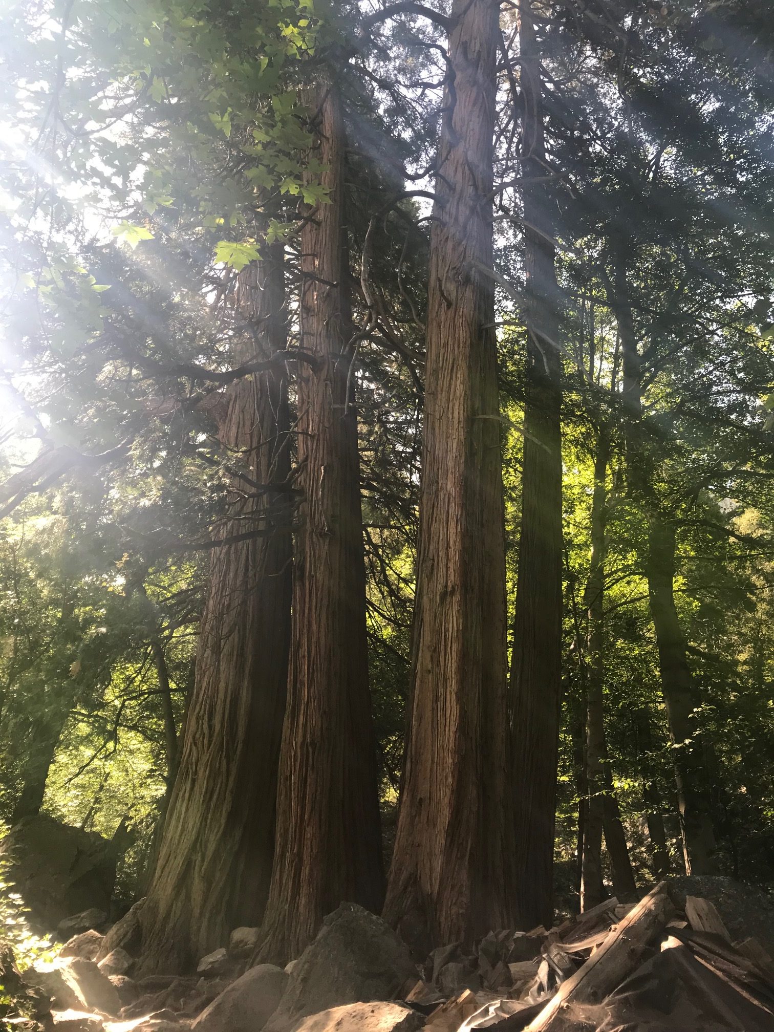
Beautiful redwoods dwarf any palm tree.
Taking in all the hobbit potential…
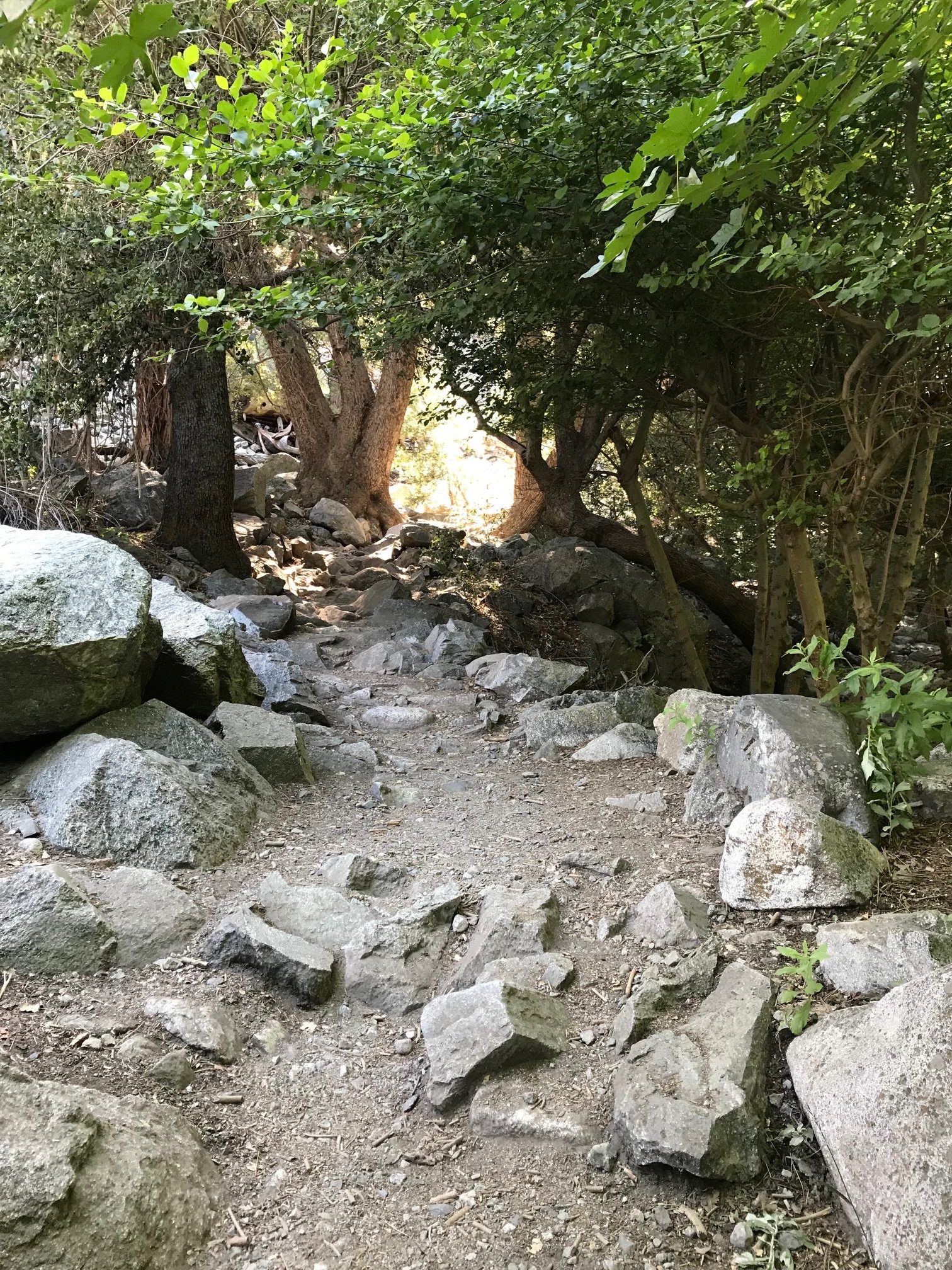
The Hike: By far one of my most favorited hikes during this challenge. For the first 2.6 miles, you’ll be hiking the Icehouse Canyon Trail, which features beautiful lush foliage alongside a rushing creek. There are also cabins and cairns to ogle at, which make this place look like anything but Southern California. Eventually you’ll make it to a rock quarry-looking area where you can observe very interesting geological rock formations. But don’t get too distracted—it’s easy to lose the trail. Veer towards the right in this quarry-like setting and you’ll come to the 2.5 miles to of the first chunk of the trail, which takes you through more exposed switchbacks and eventually to the “Icehouse Saddle.” It is during this portion of the hike where you will climb the most elevation as the saddle puts you at about 7,600 feet.
Once you get to the saddle, you can go one of three different routes. I completely geeked out because not only could I see a beautiful forest view into the valley, but I also found more trails/mountains to hike.
Signage will point you straight onwards for another 2.4 miles towards Cucamonga Peak. This trail has a lot of loose gravel, and due to frequent landslides, the gravel often covers up the tiny trail itself. This makes things slippery, so proceed with caution.
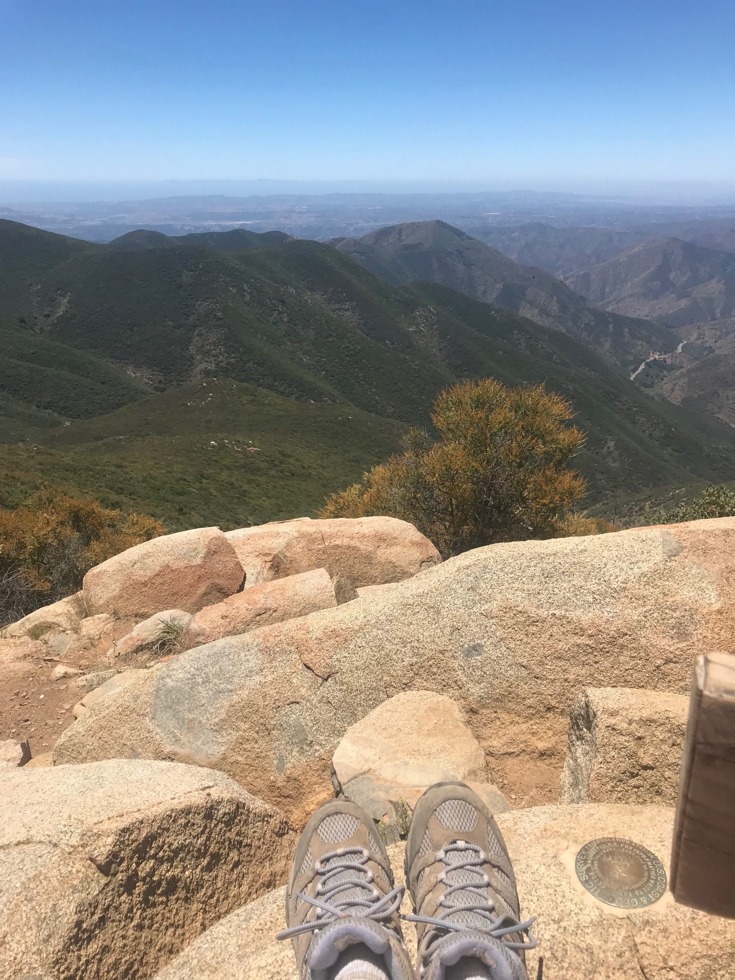
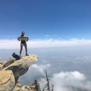
And just like this hike description, when you think it’s never going to end, it does. And the view of the inland empire and Apple Valley is spectacular. If there are clouds around, they tend to make your photos look pretty damn cool, too.
Driving Directions: From the 210 east towards San Bernardino, exit Base Line Drive, make a right onto Pahua Drive and a right onto Mount Baldy Road. The trailhead is located at the end of Mt. Baldy Road, and there is a lot for those who have Adventure or National Park passes. You can also park alongside the road without any ticketing consequences.
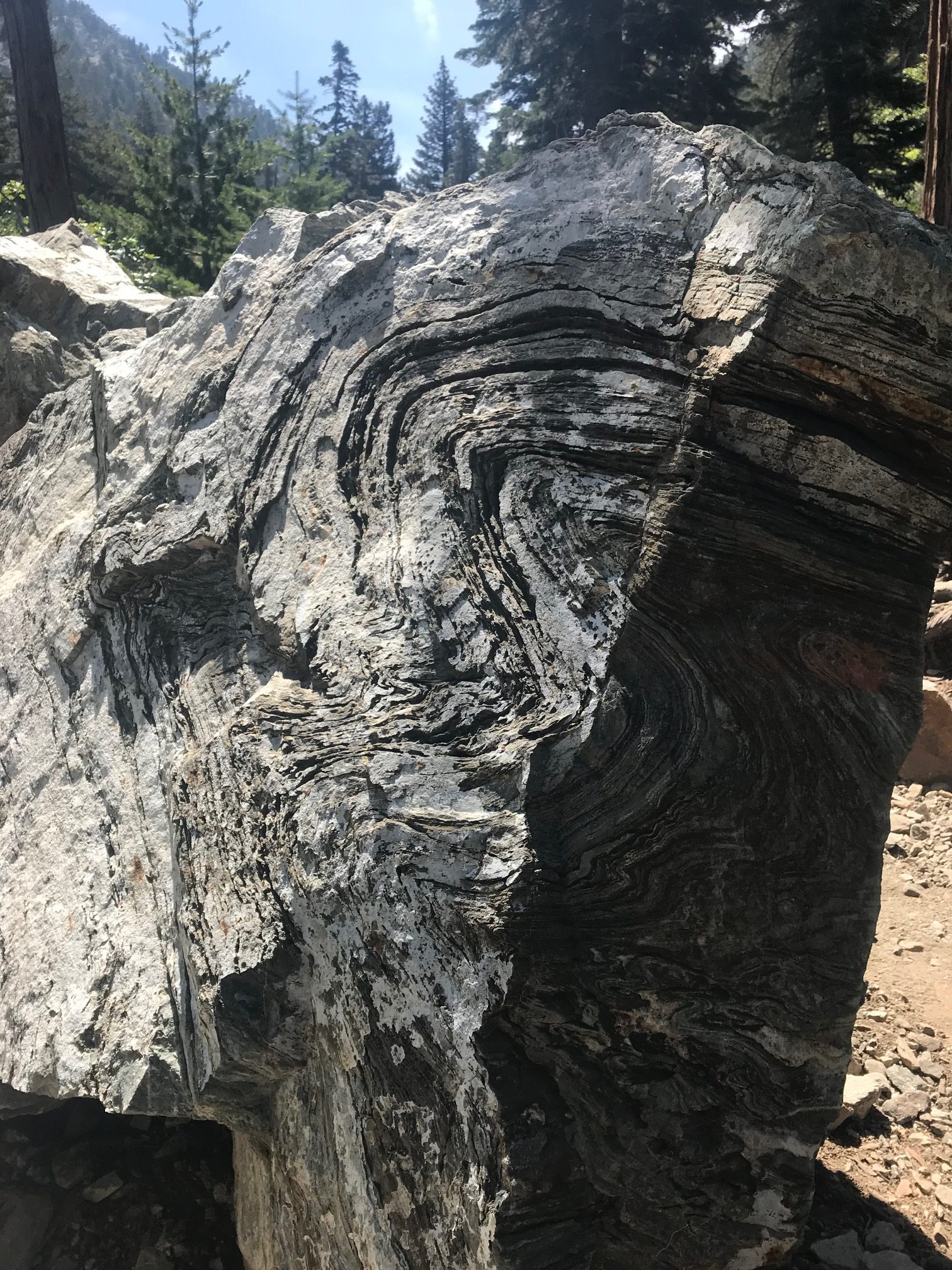
Back in the day, California was filled with volcanoes…still was a hot place to be. ha! I’m here all night.
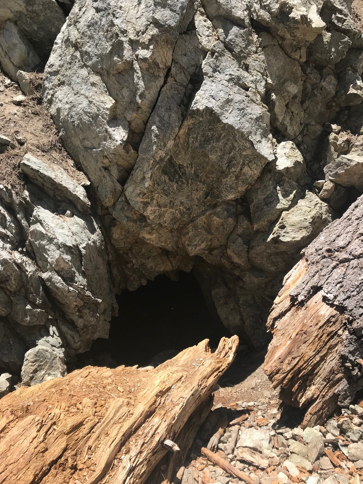
You’d walk right past it and never give it a second thought, but don’t forget to check out the old gold mines.
Roundtrip mileage: 15 miles, 8 hours
Elevation: 8,859 feet
Elevation gain: 4,000 feet
What to bring: Water, snacks, hat, sunscreen, phone/camera, Adventure Pass
Consider this: There are so many cools sights to see along this trail that you tend to forget to sip your water. Cabins, cairns and igneous rocks can easily distractify, but don’t forget to do a sanity check lest your lungs do it for you. Also, be sure to look for the old gold mines along the trail. There’s no signs that point them out, they’re just kind of chillin’, so be on the lookout. If you’re heading toward the peak, they are on your right…because to your left is a straight 1,000 foot drop.