Peak 4 of 6: Ontario Peak
Peak four of six had me climbing over downed trees and wishing for a little more water…
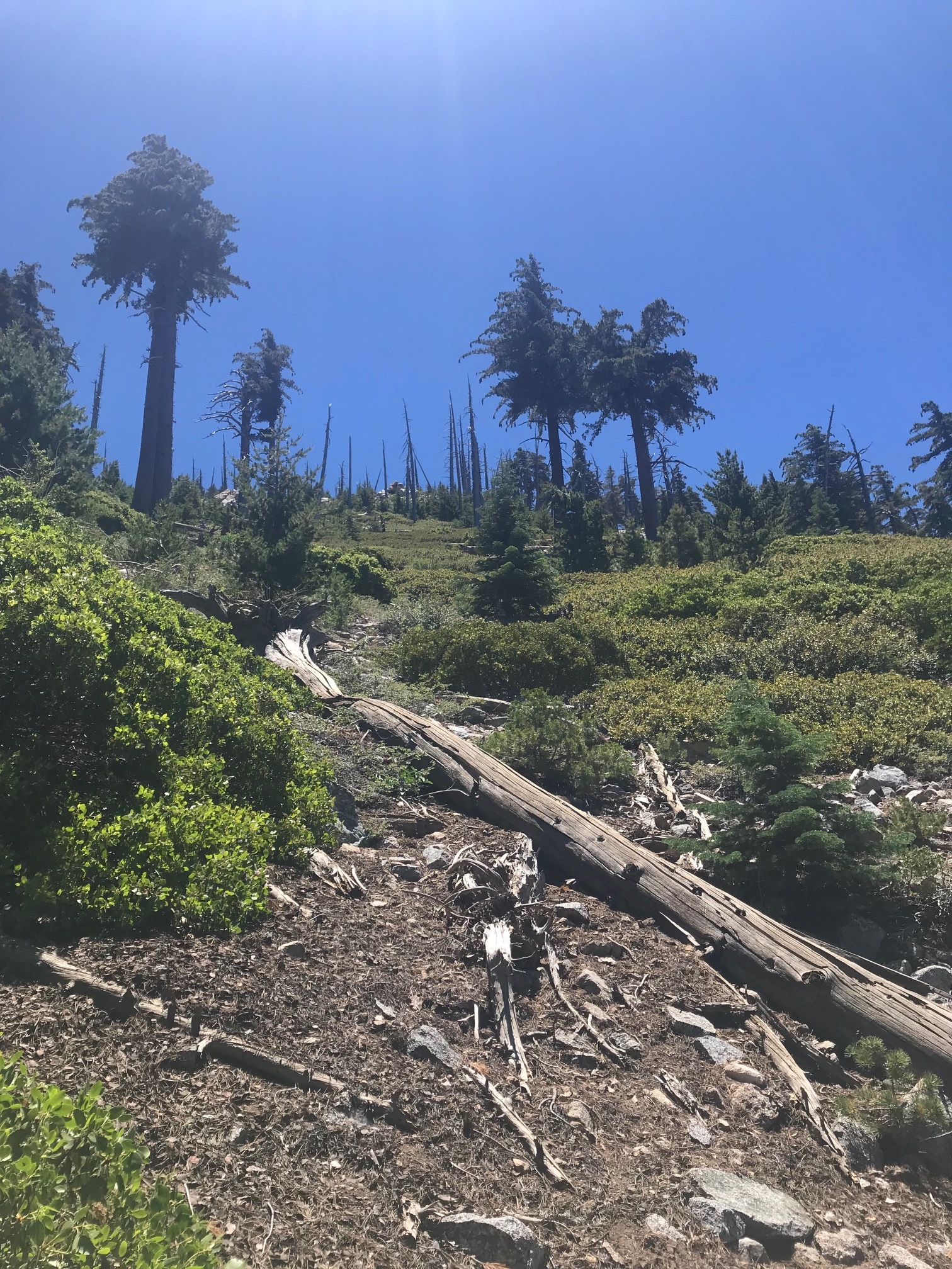
Hiking over downed trees ain’t no joke.
The Hike: You start off the same route as Cucamonga Peak—Icehouse Canyon Trail to Icehouse Saddle, which will bring you at about 5.1 miles one way and about 7,600 foot elevation. At the saddle’s fork in the road, you would veer to the right (again, this area has many signs) where you will take a skinny semi-covered trail for 2.8 miles one way to the peak. Along the way, you’ll get a fantastic view of the backside of Mount Baldy, another popular mountain part of the SoCal Six, and a real leg/ thigh killer.
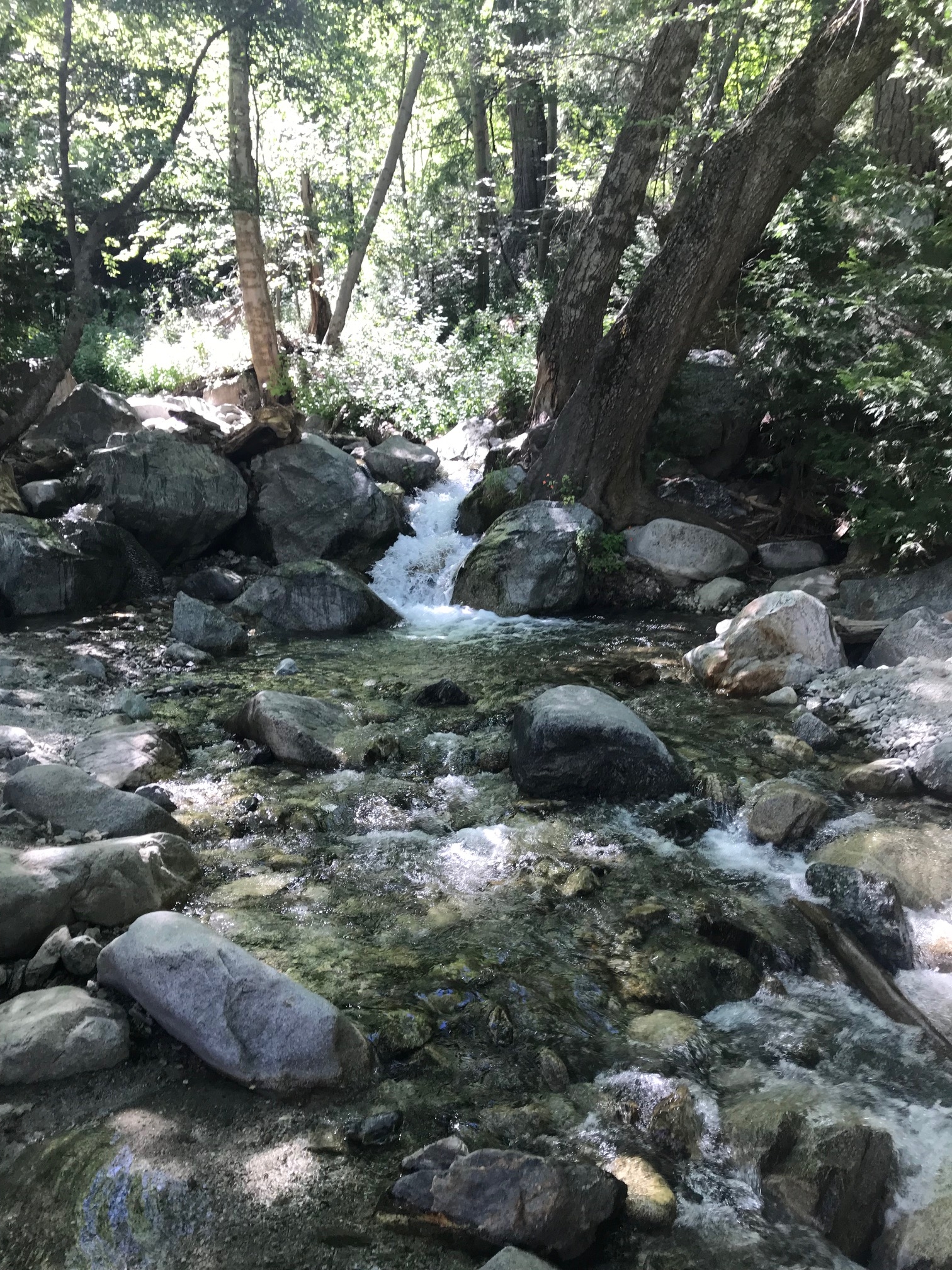
The bubbling stream that I wanted to jump in.
Eventually you’ll come to a part of the trail with tall grass and chaparral scrubs. There will also be downed trees that can impede your literal path, so you might have to hop over a few of those giants. Hike up a hill and come to a saddle area…keep going. Drink up because if you’re as smart as I was and decided to hike at 10:00 a.m. again, then at this point in the trail, an electrolyte tablet might be worth a try. I, however, had none and, therefore, once I reached the actual peak, had less than 2 liters of water left and more than 7.5 miles in midday heat in front of me. Shortly after this hike, I purchased a 3 liter bladder and electrolyte tabs.
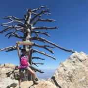
Arrive at the peak and check out the spectacular views.
Driving Directions: (same directions as Cucamonga Peak) From the 210 east towards San Bernardino, exit Base Line Drive, make a right onto Pahua Drive and a right onto Mount Baldy Road. The trailhead is located at the end of Mt. Baldy Road, and there is a lot for those who have Adventure or National Park passes. You can also park alongside the road without any ticketing consequences.
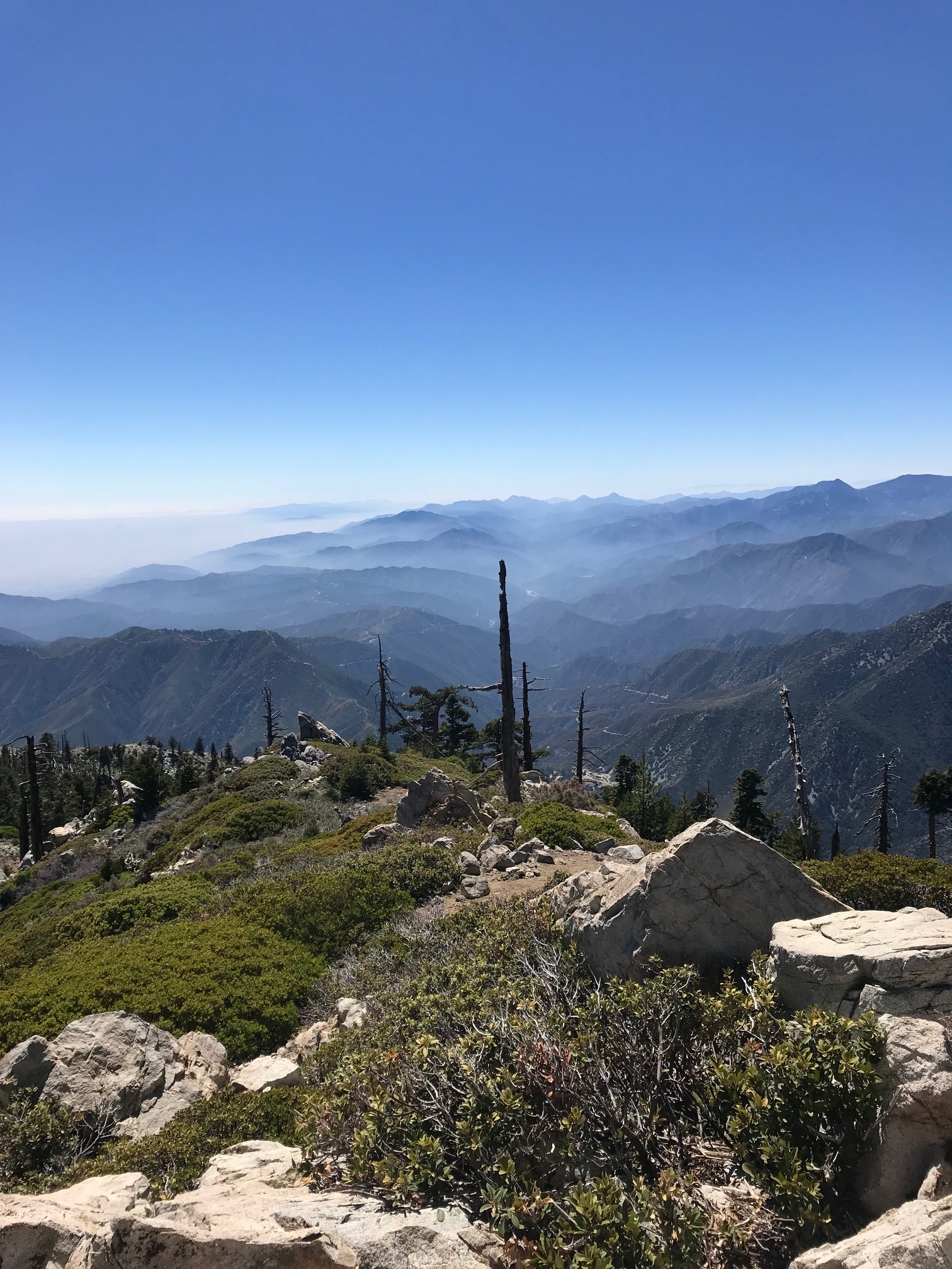
The unobstructed view from the top.
Parking: At the end of Mt. Baldy Road on the left side is a lot for folks who have an Adventure or National Parks passes. If you don’t have one, just park alongside the road.
Roundtrip mileage: 15.8 miles, 8 hours
Elevation: 8,696 feet
Elevation gain: 4,240 feet
What to bring: Water, snacks, hat, sunscreen, phone/camera, Adventure Pass
Consider this: Although this is definitely no Sitton Peak, the bugs were still quite annoying. I blame the heat because, once again, as hard as I tried to get out the door early, I made it to the trailhead by 9:45 am on the dot…with much disappointment. Knowing it was going to be a hot one, I decided to hike a little slower, sip water and stop more often.